Saturday, June 21, 2014

Weston West Virginia to Sudbury Ontario

Today will be the last day of this trip. Sandy and I will be making the approximately 660 mile run back to Sudbury while Gary and Dianne will be stopping overnight in Barrie to visit. With this in mind, we were up at first light and ready to go. The last crew had obviously arrived late last night because their bikes were in the lot when we went outside. Percy and Danielle's bikes weren't there but, when they stopped in Johnson City yesterday, Weston was not their firm destination for the day.

The late arrival bikes

Terry A had already left by the time we headed to our trucks. He is an experienced traveler and knows that a long day should start early. The two trucks/trailers that started our trip almost two weeks ago were rolling northbound on I-79 before 6:20 under cloudy skies.

Trying to save a bit of fuel, I slowed the pace to 60 MPH and Gary held in place behind us. According to the fuel consumption readout on the dash, it wasn't making a lot of difference. In Morgantown, West Virginia, we stopped at a Mickey D's to get some breakfast to go. Although in town, this one as pretty quiet and there was a lot of room to park the rigs.

Dianne and Sandy in Morgantown

Soon after, we crossed the line into Pennsylvania. I had warned Gary about the nasty curve at the bottom of the hill where I-79 merged with I-70. The tight left hand curve/merge ramp had a concrete barricade on the outside that was covered with a variety of paint streaks where drivers had misjudged either their speed or their line. Lo and behold, the killer curve was gone, replaced by a nice gradually curved ramp. I wasn't sad to see the change.

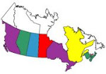
Another state closer to home


Crossing the Ohio River

We slid past Pittsburgh in light traffic. Not far north of the city, Gary L and Cheryl passed us. Although they left later, they were moving along at 65 MPH compared to my 60. The V-6 in his Acadia must have been humming right along. I came to the conclusion today that the five MPH reduction in speed didn't do a thing for my mileage. Savings can, however, be had by managing the way uphill grades are handled. Then again, I already knew that. A six speed transmission wouldn't hurt. Perhaps in a 2010 or 2011 Tahoe.

Odd that the chair is empty

Gary L passing us

Nice artwork

It isn't chartreuse but it is a micro-bus

Yup, they are still there....

We stopped at a rest area about forty miles south of Erie, Pennsylvania. I was feeling some fatigue and a bathroom break was in order anyway. A few minutes walking around in the cooler 20C temperature cleared my head and I was good to go again. We did express our appreciation of these fine facilities and wondered why Canadian freeways could not have something similar.

Gary and Cheryl must have stopped somewhere as well, because they passed us again just as we were about to reach I-90 in Erie. Once on the NY Thruway, I was pleased to note a Texting Area sign on what had once been a pullout just for big rigs. This is a nice feature that provides an alternative to texting while driving.

There was one more stop at the Angola Service Area before Buffalo to use the facilities and top up with cheaper US fuel before hitting the border. The price was high by US standards but was a major bargain compared to what we would pay on the Canadian side.

Weekend warriors at the Angola Service Area

We made it to the Peace Bridge and found out that everyone in Buffalo had decided to visit Canada on this fine Saturday. There were two lanes open across the bridge heading our way (the middle lane can accommodate either direction based on traffic). The lines moved fairly quickly, however, because almost all the Customs booths were open. Oddly, one of the biggest lines was the one dedicated to NEXUS users. We took a regular lane anyway to stay with Gary and Dianne.

Some of the older cars we saw around Fort Erie

He hasn't been everywhere but he is working on it

Most booths were open


The CBSA agent asked why we were in the regular lane and I explained. A couple of questions about our purchases and we were on our way. I let the EZ Pass handle the toll and then we waited for Gary and Dianne once we cleared several miles of orange barrels on the QEW. They weren't long catching up to us.

There must have been some kind of vintage car happening in the area. In addition to the pair of Model A's we saw in the Customs plaza, we encountered a few notable examples on the way to Niagara Falls.

I think this was a Cord 812

This appeared to be a Mercury Monarch of around 1947 vintage

Once we were through the construction around Niagara Falls, the traffic was moderate going our way. As we approached Grimsby, however, the Niagara bound traffic was heavy enough that it had ground to a halt in a few places. We splurged and caught the 407 Express Toll Route once we were over the Burlington Skyway. The 407 is outrageously expensive, but that is one reason that the traffic is typically light. Today was a typical day.

We cleared the Big Smoke (a not so affectionate name for Toronto) and found ourselves headed north on Highway 400. It was time for another food stop so I pulled into the remodeled service centre near King City. Gary and Dianne followed us but, since they were only going a few miles up the road to Barrie, we said our goodbyes and they continued on without going inside. We have been on the road together for thirteen days and they have proven to be excellent traveling companions. I hope we can do it again sometime.

After getting some Tim Horton's coffee and a wrap to go, we got back on the road for the last 240 miles. I stopped again at the Petro-Can south of Parry Sound, adding enough fuel to be sure we could make it the rest of the way. After almost two weeks of US gas prices, the cost at the Canadian pumps sure hurt.

North of Parry Sound, there was almost no traffic. We cruised along at 100 KPH, with the readout telling me we were getting about 12 miles to a US gallon. Then a semi came by and I tucked in behind, boosting this to over 15 MPG. I could use more big trucks.

We arrived home about 7:45 PM. The temperature was still 24C and we only took in the overnight bags, leaving the rest to be unloaded tomorrow. The house was in good shape except for the back lawn, where the company I had hired to cut the grass had scalped it for some reason. This would bear some looking into.

This has been a great trip. It was a pleasure to take some of our Freedom Riders family around what I consider to be some of the best motorcycle riding roads to be found anywhere. Now we will have some weeks at  home before heading back down to the same place (and even the same motel room) for Wolfman's Wandering Rally 8 at the beginning of August.

Today's route (675 Avalanche miles):


Friday, June 20, 2014

Bryson City North Carolina to Weston West Virginia

We heard the rumble as Don M. pulled out at 6:00 AM this morning. He and Roger planned to be home tomorrow and had set their sights on the same Super 8 in Grove City, Pennsylvania that we had stayed at on the way down. The rest of us were aiming for Weston, West Virginia today and weren't in as big a rush. Riders headed out in several groups with the trucks/trailers leaving last. Sandy and I led Gary and Dianne out at 7:45 AM. Danielle and Percy followed on their Harley's so they could follow us through the interchanges of Asheville.

Danielle nearly forgot her socks

The Great Smoky Mountains

The Clampett's in a rest area near Waynesville

Oh, oh......

After a stop to check the tie-downs on the bikes, we successfully negotiated the highways and byways from I-40 to I-26. We went up over Buckner and Sams Gaps and stopped for a bathroom break at the Welcome Center on the Tennessee side of the ridge. The group led by President Rob was still there. Shaun's rear tire was down to cord and they were planning to stop at a Honda dealer in Johnson City to see if they could get a new skin. That was the second tire to give up on this trip. Percy and Danielle decided to stop as well at the Harley dealership in Johnson City to check on a slow leak in her front tire, so our two trucks/trailers went on alone.

Rob's group at the Tennessee Welcome Center

We went all the way up I-26 to I-81 and headed northeast, entering Virginia about 10:15. There was a gas stop (Virginia gas is much cheaper) at the Shell in Rural Retreat. While there, we grabbed food to go at the adjacent Mickey D's. Then we reached I-77 north in Wytheville and passed through the two tunnels into West Virginia. As we cleared East River Mountain Tunnel, we could see clouds building. Up until now, it had been hot and sunny but it started to rain on the climb to Princeton. By the time we got there, it stopped.

The first tunnel

Stay away from the walls....

The second tunnel and the West Virginia border

Welcome to West (By God) Virginia again

We rolled through the first toll booth on I-77 but Gary got blocked by a truck who was being held for some reason. He had to back up and use a different lane. North of Beckley, we took the exit to US 19 and cleared the second toll booth. The EZ Pass is a great device, eliminating the need to handle change.

Toll booth on the West Virginia Turnpike

The New River Gorge

Summersville Lake

We stopped briefly in Summersville so I could wake up a bit. Then we drove over Powell Mountain and continued on to I-79.

US 19 (Mountaineer Expressway) over Powell Mountain

Shift to low gear, a $50 fine my friend....

Some unlucky soul getting cited on US 19

Finally, we reached Weston about 4:15 PM. After fueling up, we arrived at the Super 8. Biker & Chery, Nepper & Yollande, Don R & Tina  and Terry A were already there. We carried the overnight gear inside. Soon after, Ray & Mary Ann, Jack & Cathay, Terry D and Terry E arrived. Then it started to rain. Hard, complete with thunder and lightning. The area was under a flash flood watch until 6:00 AM tomorrow.

Super 8 in Weston West Virginia

Free coffee in the lobby

The rain hit hard

About 6:00 PM, we all walked over to the Peking Chinese Buffet for supper. It was OK but I restrained myself and didn't feel over-stuffed when I was done. Then we went back to the hotel where I blogged while Sandy went shopping in the strip mall. She finally managed to find a set of running shoes that fit and a pair of camo Crocs.

As I write this, there has still been no word from Rob's group or Danielle and Percy. It is now dark and I hope this just means that they have decided to lay over somewhere due to the weather. Sandy and I plan to leave at first light tomorrow and run the entire 660 miles back home. Others have different plans.

Today's Route (409 Avalanche miles):

Thursday, June 19, 2014

Bryson City North Carolina - Free Day

As I mentioned in yesterday's post, the organized group ride was cancelled for today. Most people felt that they wanted to recharge their batteries before heading for home tomorrow morning. So today was unstructured.

One thing that was on the agenda for some today was a visit to Wheels Through Time, a vintage motorcycle museum over in Maggie Valley. Some of us weren't in a rush so Blaine led an early  group over the ridge, a ride of about twenty miles. I left later and led Biker, Don R. and Mike the same way. As we were leaving Bryson City, I had to pull over because all the police cars in the area were hightailing it towards Cherokee with blue lights flashing. We never did find out what that was all about. We caught up with the others at Country Vittles, a favourite Maggie Valley breakfast spot.

Don M., Paul and Rick having a Country Vittles All You Can Eat Family Style Breakfast

Dan R. and Shaun at Country Vittles

A good spot to eat

After breakfast socializing

Biker and I escorted Don and Mike to Wheels Through Time, where others had already arrived. Neither of us went in because we had been there before.

Biker at Wheels Through Time

Terry A. at Wheels Through Time

Biker and I fueled  at the Shell in Maggie Valley and then started back up US 19 to Soco Gap. We were following three vehicles by the time we reached the passing lane near the  top. The second car pulled into the right lane but the lead car stayed in the left, as did the pickup truck running third. They paced each other, not letting us by. This was the last chance to pass before the winding descent into Cherokee and I was steamed. Finally, the car in the right lane got a little ahead allowing Biker and I to slip through at the last minute. The offending car was driven by a young lady who apparently did not have a care in the world. Or a clue, either.

We got back to Two Rivers just before noon. I took Sandy to Mickey D's in the truck to get smoothies for her and Tina. The face at the Drive Thru window startled me a bit.

Wanted smoothies, got this.......

Back at the motel, I posted bills and did some MS Society work. There were clouds building on the horizon, so we all hooked the trailers up, packed the big suitcases and loaded the bikes. It was a good thing we did because the rain came down heavily during the afternoon. Later, it cleared and we had a pleasant evening.

Blaine and Kathy put on a supper for us for a nominal fee. We had all the hamburgers, hot dogs, beans and potato salad that we could handle. As if that wasn't enough, we had three kinds of cobbler (blueberry, apple and peach) with ice cream for dessert. They were cooked in outside Dutch ovens using hot coals from the grill. I have to say that Blaine and Kathy have been the most awesome hosts. And very nice people to boot. I will be suggesting to club members that they put reviews on Tripadvisor when we get back. Sandy and I are looking forward to retunring in early August for VROC WWR8. We even have the same room reserved.

The clouds before the rain

Sandy with master chef Blaine

Kathy replenishes the potato salad as Danielle gets some beans

Cathay getting some cobbler

The evening was quiet. People were subdued in anticipation of the trip home tomorrow. It seemed like the trip had been a success thus far so my part was done. It was a real pleasure to share one of my favourite areas with my Ontario motorcycle family.

A relaxing evening

North Carolina sunset behind the trees

Wednesday, June 18, 2014

Bryson City North Carolina - Great Smoky Mountain Parkway and The Dragon

The planned ride today was a loop through the Great Smoky Mountain National Park and across to US 129, returning through the Tail Of The Dragon. The ride was to leave at 9:00 AM, fueled and fed. Sandy would be riding with me today so we would have some pictures on the road. President Rob told me that he would lead a second ride on the same route, leaving half an hour later. His intent was to poke along a little more.

Our group got underway according to schedule. VROC compatriot Southern Draw of Bryson City joined us for the ride and took the sweep position. We proceeded to Cherokee and turned north on US 441, the Great Smoky Mountain Parkway. After a stop at the Oconaluftee Visitor Center, we rode on up through the park. This road runs between Cherokee and Gatlinburg, Tennessee and traffic can be quite heavy, but we did OK today getting up to Newfound Gap and the Tennessee line. There was a bit of construction near the top but nothing really slowed us down.

Bikes at the Oconaluftee Visitor Center

Terry A and Don just behind us on US 441

The Great Smoky Mountain Parkway - NC side

Mild construction near the Gap

Group photo - Newfound Gap

Where we just were

Danielle and Southern Draw

Yollande and Nepper

We started down the Tennessee side. Last year when TBone and I were here, this side had much poorer pavement. The descent started with a series of 20 MPH curves and one left hander had a small road going off to the right. Perhaps the jeep driver going uphill was thinking of exploring it. Regardless, he was looking that way as the jeep came over the centre line at us. He looked back at the last second with surprise on his face as he steered back into his own lane. Freedom Riders do not like people who cross centre lines.

Moments later, a jeep nearly took us out in the curve ahead

The first part of the way down was old pavement and a few tunnels. Then it was construction all the way down. There were three spots where flagmen were set to stop traffic. We got to the first two as they were letting our side through. At the last one, we had to wait for a couple of minutes.

There were a few tunnels on the Tennessee side

Road construction everywhere

We had just passed over the bridge we are going under

 
 Rubbing elbows with rock formations

We finally reached the park Visitor Center at the north end. The road ahead led to Gatlinburg, a place no one should ever want to go to in the summertime. We turned left and followed the Little River Road, also known as Old Highway 73. This was a very scenic ride with a 30 MPH speed limit. We were doing about 30 when we caught up to three vehicles. The lead car was a Buick crossover that was doing 25 MPH and slowing to less than 20 in the corners. This was too slow to ride and  I kept wishing they would pull over at one of the many paved pullouts. But I guess it was all about him (or her). Finally, they continued on to Cade's Cove (another crowded place where no one should want to go) while we turned north towards Townsend. Still, I would recommend this road for an enjoyable ride.

In Townsend, some topped up the fuel tanks and then we looked around for a place to eat. Smokin' Joe's Bar-B-Que had an empty lot and an Open sign so we gave it a try. They were empty because they had just opened and quickly set up a table for us. The server was typical southern hospitality, calling people "Honey" or "Sweetie" as she quickly got our orders taken and brought drinks.

A man was unloading the smoker out front while we waited. The food was worth the wait. I had a small brisket sandwich with hushpuppies and coleslaw. Southern Draw confirmed that it was really good BBQ. By the time we left, patrons were lining up at the door to be seated. Once again, luck was in our favour.

Eat here when in Townsend Tn

Free museum we didn't have time for

Leaving Townsend, we headed for the Foothills Parkway. The curves through here are very mellow with no unexpected surprises. The ride across here brought us back to US 129. I thought I was north of the Highway 72 split where we had lunch yesterday so I was waiting for that intersection when I led past the place where Ray boosted Gary on our last trip. A Sheriff's car was giving a mini-Cooper a ticket there. I almost didn't get stopped in time to turn into the parking lot at the tip of The Dragon, but we made it.

The start of the Foothills Parkway

The Dragon was again an individual run. Don headed out first, followed by Terry A. Then the others left, with Sandy and I leaving last. A few corners in, we were starting into a blind right hand curve when we met a very long bus conversion diesel pusher RV towing a car. The centre of the unit was taking up three quarters of our lane as he came around and I had to take the right edge of the pavement to get by. That was a close one.

I had promised Sandy an easy ride. What I found was that it is easier to ride hard and harder to ride easy. We passed a few of our group who had stopped at the Scenic Overlook. Then we rolled along until we caught a Harley rider with a Go-Pro camera on his helmet recording a girl on a cruiser ahead of him. I just settled in behind them and relaxed for the rest of the ride. The Wing temperature gauge was at the top as we hit the Gap and the North Carolina state line.
 

The Tail of the Dragon

Another Dragon curve

We all stopped at the Deals Gap Motorcycle Resort. The parking lot wasn't very busy. Danielle and Terry E were the last in because they stopped to assist a bike that had missed a corner going the other way. For some, it was the second time here in two days. Don pointed out where he had hung Rick's mirror on the Tree of Shame from the get-off yesterday. A few riders coming in from the east were wet, so the showers were out there.

Dragonslayers Part Deux

Don points to Rick's mirror

We left the Resort down US 129, a stretch some call the Mini-Tail. It isn't vary far down until it makes a hard left across a bridge. From here, the Cheoah Dam, aka the Fugitive Dam is visible.

The Cheoah (Fugitive) Dam

The road was wet as we started into the broad sweeping curves leading by the river towards Robbinsville. There was a motorhome ahead of us but he pulled over before long and let us by. That didn't do much because we came around a curve and found the road blocked. At first, I though it was a wreck but it was actually a large tree that had fallen. It couldn't have happened very long ago because there was only one car waiting on our side. There was a NC  road crew on site but they were line painters and didn't have the required equipment.

If a tree falls in the forest.....

He's a lumberjack and he's OK.....

Not able to continue, with tears in our eyes we turned around and rode back up to the Us 129/NC 28 intersection where we started back down the Hellbender. This is now known as the upper end of Moonshiner 28. We didn't stop anywhere until we got to Wolf Creek, where the highway turns to four lanes. The only reason I did stop was to offer the riders a chance to put on rain suits. No one did so we continued on, getting a few drops for about a mile. We arrived back at the Lodge at 4:15.

Rock formation on NC 28

Kickstand Lodge

People went their own ways for supper. Sandy and I ate what we had in our room. Everyone was pretty tired and would be heading home on Friday so we decided to cancel tomorrow's organized ride and have a free day. We were concerned about Rob's pokey group but they finally arrived after 9:00 PM. They went to both Cade's Cove and Gatlinburg in their travels. There were S'mores at the fire in the pavilion. I was one of the last to turn in at 10:45.

Today's Route (151 motorcycle miles):