Monday, June 30, 2008

Missoula Montana to Vancouver British Columbia

We got off to a slower than intended start this morning. Knowing that we were more than half way and that we would pick up an hour due to the time zone, there was no sense of urgency. Over our toast and coffee, we talked to a couple about our age from Cranbrook, BC, who were headed to Alliston, Ontario for a month on a home exchange program.

It was already warm out when we headed west on I-90, where was a noticeable haze over the valley. Unlike yesterday, when we could smell fire smoke, the culprit was easy to spot.

We had our daily deer experience early today, and I didn't have to be the primary driver. A small pickup truck ahead of us was on the brakes before I saw the deer on the shoulder pointing across the road. I braked aggressively and the deer, as the truck approached, turned and jumped a fence. Sandy got a picture of it (the small shape in the centre) as it turned back to look, just before I sent it running with a blast on the quite effective GoldWing horn.

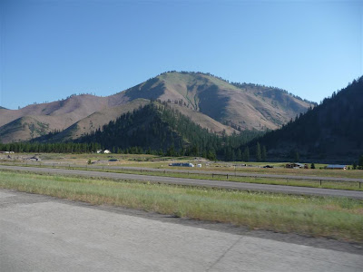
Montana terrain gets rougher as you go west. We spent a long time riding along the Clark Fork, the largest river by volume in Montana. I had never heard of it before, but it drains a huge area up to Lake Pend Oreille in northern Idaho which then flows into the Columbia River. Sandy did get a shadow photo of us as she held the camera high to get her desired angle.

We crossed into Idaho over Lookout Pass, descending into another valley and then climbing again to 4th Of July Pass. Then we approached Coeur D'Alene on a high road overlooking the lake of the same name. From there, we soon came to the Washington Border (following a jerk in a Washington plated pickup truck who wouldn't move out of the left lane), and Spokane. The community of Spokane Valley seemed to take their cue from Scottsdale, Arizona with respect to business signage. Luckily, the Zumo was able to find us food and gas.

From Spokane, we took US 2 West, a two-lane road through mildly rolling and well irrigated farmland. At Wilbur, we turned north on SR 174 to Grand Coulee. Before we got there, parts of the farmland gave way to sagebrush and lava rock. It seems some of the terrain is too rough to farm.

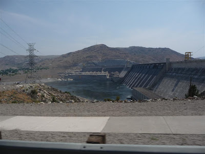
The Grand Coulee Dam across the Columbia River is the largest electric power producing facility in the US. Completed in 1942, it is 5,223 feet long.

Crossing a bridge below the dam, we turned northwest on SR 155 across the immense and very dry Colville Indian Reservation. This road did not have a lot of traffic and it wound through the hills in a very enjoyable manner. I'd give it two thumbs up if you are ever in the area.

We left the reservation and SR 155 at Omak for US 97 North. Strangely, 155 doesn't even warrant a direct connection with the two-lane 97 so we were forced to take back streets through Omak to connect. While there, we had to stop for two ambulances responding to a residential dwelling. I'm sure there was a story there, but we didn't hang around to find out.

Temperatures were rising as we headed north towards the Canadian border. The valley was irrigated and contained many apple orchards, among other things, while the hills were dry and covered with sage. Sagebrush probably should be the official US plant, considering there is so much of it.

We arrived at the border, weary travelers returning home on the eve of our nation's birthday. The experience was less than it could have been, however, as we sat stopped in a line at 39C (102F) for a half hour while NOTHING moved. Then the line started gradually. Although there were six booths, only two were open. When we finally got to one, the agent was nice enough but he talked R E A L L Y S L O W L Y. Looked like one more work to rule day. Give them their firearms, already.......

Taking Highway 3 West, we could see a large cloud on the horizon. With the heat, we were actually hoping for rain. I stowed my wallet and notebook in the trunk just in case and we headed on. In Princeton, it started to rain and then picked up. We were right on the edge of it and, with the sun ahead of us, it was difficult to see as we ran through the hairpin turns. Soon, we were out of it and the pavement was dry.

Near Hope, we passed the site of the massive 1965 Hope Slide, one of the largest landslides recorded in Canada. It killed four people who were traveling the highway at the time. On a trivia note, Hope, BC was the filming location of the movie First Blood, which introduced the world to John Rambo (although the movie purported to be placed in Hope, Washington).

From Hope, we followed Highway 1 at a good pace (I know, Slammer, speed). The traffic wasn't too bad and we reached the outskirts of Vancouver in no time. I made use of the diamond lane, which had little traffic since most vehicles only had one person. There was a sign that said "Motorcycles OK", unlike the yoyo's in Ontario who prohibit solo bikes in HOV lanes.

We arrived a Malcolm's apartment about 7:00 PM Pacific Time. He came down to help us carry our gear up, but left his outside door key in the apartment. This is a point at which one becomes dependent on the kindness of neighbors, even if you don't know them. Someone he buzzed did let him in. The apartment over Ambleside in West Vancouver has one of the nicer views I know of anywhere. To the left, the Lion's Gate Bridge; across the way, Stanley Park and to the right, English Bay.

We had a supper of gazpacho, pakoras and salad. I may get healthy yet:-)) Then we visited and inflated the air bed where I got to sleep. Sandy took the couch, saying that sleeping with me on the air bed would mean she would roll into the depression my larger mass created. I remember a demonstration of gravity that worked the same way, showing how mass distorted space..........

More Western Scenery

Western Montana


Washington State - North of Spokane


Washington State - Grand Coulee Dam


Washington State - Osoyoos Lake


British Columbia

Sunday, June 29, 2008

Lead South Dakota to Missoula Montana

Slammer got away at 5:02 this morning according to VSP, heading to see his sister in Manitowoc, Wisconsin. Clark, Rhonda, Matt and his girlfriend were Nebraska bound by 5:45. We were packing up when I saw that something had happened to the Wing Trevor was riding. Ask me no questions and I'll tell you no lies.

It was clear but quite cool and so we set out at 6:45 wearing some of our cold weather gear. We rode to Deadwood and then the GPS sent us to Spearfish on US 85. This was a new road to us, the very thing we look for whenever we get a chance. The highway ended at I-90 where we turned west.

Before we got to the Wyoming border, I was running downgrade when I spotted a fairly large white-tail standing in the median pointing at my lane, so I got on the binders and slowed right down. The deer moved across in front of us but I waited another moment to make sure it didn't change its mind. Slammer quite rightly observed a few days ago that when you meet a deer, neither you nor the deer has any idea what it is going to do. We were pleased most of the day to see large qualities of the more intelligent antelope and fewer scatterbrained deer (except for many carcasses on the side of the road).

In Wyoming, we stopped at Gillette (Energy Capital of the USA) for gas and breakfast. Then we slid by Buffalo and Sheridan (Cowboy Capital of the USA) with the Bighorn Mountains to our left.

Near Garryowen (anyone remember the 7th Cavalry's theme), Nebraska, we could see the Custer battlefield site to our right along with all the buildings of the Visitor Center. Without the zoom, it is hard to make them out. The Little Bighorn River was right beside us and there was a significant native presence. I found later that today was the last of three days of re-enactment of the battle, but we didn't have time to hang around and wait for it.

I screwed up with my gas stop in Bozeman. I had selected a station to give me a mileage and then went to it when we got there. Unfortunately, this one was 2.5 miles off the Interstate and the temperatures were getting ever hotter. I do believe I found one cause of the elevated temperatures since it has been occurring when I have the main Baker Air-Wings open. I think this may be altering the flow of air through the radiators.

Butte, Montana is a significant mining town. The copper pits dominate the landscape both in Butte and in the outlying areas. Missoula, on the other hand, is a pretty city with many trees. The temperature hit 37C (98F) as we hit town and stopped for fuel. Although we were aiming for St. Regis, where Sherm got to yesterday, we decided to knock off here in Missoula after 690 miles. The Super 8 here is nice with a strong WiFi signal and flat screen TV's.

For supper, we went across the street to the Montana Club. This is a family restaurant with good food and reasonable prices. In the interest of cutting back, Sandy had a Caesar salad and I had a chef salad. No dessert. The only complaint I had was with the parents of a young child who thought it was cute when their little demon shrieked. This encouraged more shrieking. Are these people so self-involved that they think the rest of the world finds this behaviour acceptable? I turned off my ears as a personal solution to the problem.

Tomorrow, we will head to Spokane, proceed north to Osoyoos, BC and then follow Highway 3 to Hope and 1 on to West Vancouver. It looks to me like 638 miles. It might be faster, road-wise, to stay on I-90 to I-5, but it will be Canada Day Eve and I am banking on a better border crossing farther away from the built-up areas. We'll see how this works out.

Montana Scenery From I-90


Saturday, June 28, 2008

Around Lead South Dakota - Day 3

A Slow Day

Sherm left just after 6:00 this morning, planning to make the over 1,400 miles back to Coos Bay in two days. It was sad seeing him go since we have ridden together and shared rooms for over a week. Sherm is one of the best people we have ever traveled with. Rem and Evelyn beat him out on the road by a little bit, heading back to Kansas.

Since we will be leaving tomorrow for Vancouver, we decided we were going to do nothing today. I went to the restaurant with the computer but still in my pajamas. I had yet one more breakfast buffet, this time concentrating on the eggs and bacon with pancakes for desert. It has been impossible to cut back my eating here because there is so much food and it is so good. I did my blog and posted my bills and then updated the blog on-line via Jamey's laptop.

After breakfast, we read and hung out with whoever was not out somewhere. Then we took a nap, waking with a really sluggish feeling. Lunch with VSP in the restaurant cleared that up, with me restricting myself to a grilled cheese sandwich. Then VSP, Slammer and I watched the USGA Ladies Open on the big TV in the lodge. El Nomad, having returned from watching the Shriner's Circus parade in Deadwood with June, was obviously not as thrilled with the golf coverage as we were.

Golf wound up and we moved outside where the group around the picnic tables expanded as people got back from their rides. It had been cold and overcast all day here, but Clark and Rhonda said they got sunburned down by Custer.

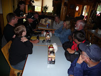
The Aztec survivors retired to the dining room about 6:00 for our final dinner. The table consisted of Sandy, Trevor, Mike, Jamey, Melanie, Mary Lou, Slammer, Waterman, VSP and yours truly (behind the camera). Missing were Jill and her sister Dawn, who were reputedly shopping at Victoria's Secret in Rapid City. Supper was, as usual, just fine. Slammer even liked his steak.

Just as we got our orders in, a horde of people came through the front door and took up just about every chair remaining in the place. Trevor, being the gentleman he is, jumped right up and started helping pour water and ice tea.

After supper, we sat outside for a while and then moved in where it was warmer. Jill and Dawn got back from Rapid with their VS purchases which they showed us but did not model. At about 11:00, the last few of us still up turned in for the night.

Aztec - The Summary

Aztec was a first year rally, although it returned us to the Black Hill where the WWR was held two years ago. Attendance was light, but then established events including VROC at KSL and Boscobel were significantly down on attendees too. Things are afoot. That said, the Recreational Springs Resort, while rustic, was very bike friendly and had great food. We could have done very much worse. There were a minimum of organized activities and this suited me just fine as well since we were then free to pick and choose what we wanted to do. Lead, Deadwood and the area have roads and history aplenty to be explored.

It was good to hang with old friends, meet new people and get to better know some of those we have just met in passing other places. Sometimes the smaller gatherings allow this more easily than the bigger ones.

Thank you, Jamie and Melanie, for putting this together. We had a great time.

Friday, June 27, 2008

Around Lead South Dakota - Day 2

It was another good morning in the Black Hills. After a brief discussion, neither Sherm nor we wanted to travel too far. Sandy and I joined the crew in the bar for the buffet and blogging session, and shared the camaraderie of the breakfast table. Sherm let me use his computer again to let me update yesterday's blog.

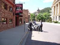
The groups again headed out for their own particular daily goals. Some went to Devil's Tower, Don went to Rapid City and some headed for parts unknown. As for us, we took the long journey down to Deadwood on the back road, where we were early enough to find it relatively uncrowded. After parking on a side street, we walked over to the main drag. Deadwood has a special dispensation that allows table gambling without tribal involvement, so every hotel and bar has slots and many have blackjack and craps tables.

The most famous occurrence in Deadwood, the murder of James Butler 'Wild Bill' Hickock by Jack McCall, took place in the Number 10 Saloon. There is a Number 10 Saloon prominently located on Main Street, but this isn't the original location. That can be found further down the street on the other side. In the back, downstairs, is a Wild Bill interpretive site with some relics and facts about Hickock's short sojourn in Deadwood.

After paying our respects to Bill and visiting a couple of shops without making any purchases, we followed the road back to Mt. Moriah Cemetery. This lies at the top of one of the steepest hills I have ever ridden up. The lady at the gate told us that sometimes it took all day for the funeral procession to wend its way up to the cemetery and the burial would be conducted by lantern light. We visited Wild Bill's grave and the adjacent one of Calamity Jane, whose dying request was to be buried beside Hickock. I offer my apologies to my friend Jim for not visiting Seth Bullock's grave, but he is planted about 1/4 mile behind the cemetery up about 750 feet higher, and I didn't intend to suffer a coronary trying to make the climb.

From Deadwood, we rode up to Lead and had lunch at Subway. Then we went across the street and joined a tour of the Homestake Mining Company. Homestake started mining gold in Lead over 100 years ago and operated until the late 90's when Barrick acquired the company and shut the operation down permanently. The Open Cut, a huge pit, lies immediately adjacent to downtown Lead while the underground operations worked down to 8,000 feet via two stages of shafts. The processing facilities were very similar to those in Timmins, Ontario, notwithstanding the vertical terrain. Now Homestake has been selected for another underground neutrino observatory just like SNO in Sudbury. This area has a great deal in common with my several homes in Northern Ontario and I feel quite comfortable here.

We got back to the Lodge in the mid afternoon, where we read, watched some TV and visited. Waterman, Els and Vicki arrived from Colorado, our final expected guests. The supper buffet in the Lodge got underway about 6:00 PM and was delicious. Then Melanie continued the festivities with a VROC trivia contest, rewarding correct answers with prizes. Some of us were limited in the number of answers they could provide. After supper, we hung out in the bar until it was closing time due to the cold temperatures. Then the few of us remaining sat outside for a while before shutting down about 11:00 PM.

For yet one more perspective on the rally, Jamey T. is running the official Aztec Rally Blog.

(Thanks to Jamie T. for the use of his computer for this post)

More Black Hills Scenery

Deadwood, South Dakota


Homestake Mining Company
Lead, South Dakota


More Aztec People

VSP, Slammer, Purple, Bulldog, Rhonda, Evelyn and Clark

Bulldog and VSP (plotting his route home)

Clark, Sharon, Dave & Evelyn

Jill's new tattoo

Thursday, June 26, 2008

Around Lead South Dakota - Day 1

It was a good morning. We had a fine breakfast buffet at the Lodge, with thick-cut bacon done as perfectly as at the Outpost Café, sausage links and patties, scrambled eggs, French toast, pancakes, biscuits and gravy. The orange juice tasted freshly squeezed.

I managed to get the blog updated despite not being able to connect to the WiFi. I wrote off-line in Word and got the photos lined up, then transferred them to Sherm's computer and posted from there. I was also able to check my mail, although checking out the VROC newsgroup was going to be more effort than it was worth for a couple of days. We'll be back on-line ourselves somewhere on Sunday evening.

With the blogging up to date, I took a few moments to wipe some of the encrusted bugs off Pogo while visiting with some fellow Aztec rallyists. It is amazing how, every time I get out a cleaning rag, people run to get cameras. I'm not the only one who doesn't clean the bike that often, but I have somehow become the poster child.

In the midst of this, Steve (Scorpion~) headed back for the Washington coast on his sinister black Harley Davidson. Steve is a laugh-riot and we enjoy any time we can spend with him. In fact, we expect to stop by and visit him in the next couple of weeks.

The rest of the people headed out in small groups to visit different parts of the Black Hills. Sandy, Sherm and I decided to make a short loop down the scenic Spearfish Canyon to the town of Spearfish and then swing of to Sturgis before heading back up to Lead.

The entrance to Spearfish Canyon was under construction for a few hundred yards. Wed had to wait for ten minutes or so while oncoming traffic cleared the single lane section and a man with no hair on his head but a spectacular long ZZ Top beard moved his pint-sized excavator off the road. Once we were through the construction, we set out down the winding road at a moderate pace. In South Dakota, a 35 MPH curve means 50 MPH (unlike North Carolina, where 35 MPH often means 32). The canyon hasn't changed since I was last here, but the few facilities do seem to be expanded.

In the lower part of the canyon, we caught up to a log truck, but he wasn't our problem. He was behind an SUV that was following a silver car that was only doing 30 MPH on the straights and was braking for the corners. I couldn't see the plate but I was betting it was FLORIDA. Finally, in a short straight, we moved out to pass. The lady (it was a lady) had, predictably, sped up. I don't know if she thought that was doing us a favour or whether she thought that was the way to drive but, after passing the log truck and the SUV, I was doing 85 MPH when I finally got past her and rolled into the next 35 MPH corner.

When we reached Spearfish, we took I-90 East at a good pace running tight formation and got off at the first Sturgis exit. After stopping at a Pamida store for water, snacks and books, we went to downtown Sturgis and parked across from Gunner's Lounge. It was much quieter than Bike Week and there was no problem finding a place to park. After a short walk down the street and back, we were back on the bikes heading back to Lead. I did Bike Week once and, with all the crowding and people, that was enough for me.

We rode through downtown Deadwood and Sherm wanted to stop and get a picture of the No. 10 Saloon where Wild Bill Hickock met his end, but there was no easy parking space so we decided to come back later. The ride up to Lead was nice with large, sweeping turns.

Back at the ranch, everyone else was still out on the road so we took it easy for a while. Jamey T., co-organizer, dropped by and the Colorado gang, El Nomad, Goofywizard and their significant others wandered in. El Nomad was having some problems with his Nomad, which he had brought instead of his Wing. It sounded to me like a sensor problem I had years ago and I directed him to a Tech Archive post I had made. Sherm checked out the wildlife while Tom the Turkey checked out Sherm. Soon after, Superman and his wife, son and son's girlfriend arrived from Nebraska.

About 6:00, we rode the five miles down the hill to Lewie's Saloon & Eatery for burgers. Sandy and I were good and had salads with chicken. The ZZ Top excavator operator was at the bar and Sherm had a chat with him. He said our delay was, luckily, shorter than most. After supper, we headed back up the hill, with Sherm and I running a pretty good clip. In fact, Sherm overshot the Lodge turnoff and had to make yet one more U-turn.

We spent the evening sitting out front of the rooms visiting and shooting the bull. The rain started up, announced by thunder and lightning over the hills. One by one, people wandered off to bed and I finally returned to my room where I fell asleep watching more George Carlin retrospectives on HBO.