We, along with Willie Wonka and Mike (Silverbiker), decided it looked like a fine day to catch up on our riding. We left town going north on 89 to the Custer State Park gate. The $5 each covered access to the park for a week. We headed on up the Needles Highway.
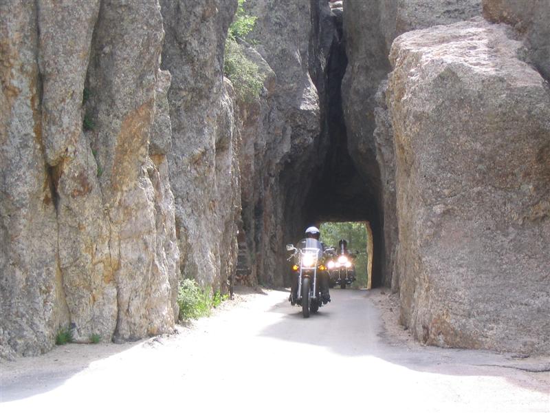 The Needles are awesome vertical rock formations. They are near the end of the steep and winding road we started at. At the Needles, there is a parking lot and then the road passes through a tunnel. As we were looking around, I heard bikes coming the other way and figured them coming through the tunnel would make a good picture. I had no idea who was coming but, after getting some pictures, I saw it was Scotty from Michigan. Scotty and I have traveled far and wide together in the past. His partner Marlene and brother Wag were with him.
 A little ways along on the other side of the tunnel, there is a scenic overlook. We stopped and got a picture of Willie Wonka with the Needles in the background. For those who know bikes, Willie has a Kawasaki Vulcan Classic with Suzuki Cavalcade trunk and saddkebags, a Harley fairing and a Honda sound system. Willie tinkers a bit and he also has an 1800 GoldWing at home.
The Needles Highway is the type of road we like to ride; tight, twisty and in good condition. Cars we came up behind pulled over and let us go as soon as they could.
 At the end of the road, we turned left on 16A and stopped in at the Custer State Park Visitor Center, a very nice facility. There were four rangers on duty and Pat Sharp appeared to be the ringleader. She’s on the right in the photo and we had some good laughs with them.
From the Center, we continued following 16A, which became what is known as The Iron Mountain Highway. This is even tighter than the Needles Highway. We wandered up and down, around and around. We crossed a meadow where burrows were begging for food. We went up the switchbacks to the summit where we could see Mount Rushmore and, once again, ran into Scotty, Marlene and Wag. We descended more switchbacks and crossed the Pigtail Bridges, where the road loops back under itself with the upper supported by timbers. We went through tunnels that framed Mount Rushmore, miles away.
Finally, we arrived in the town of Keystone, which I don’t ever remember seeing before. It is, how shall I say it, tourist oriented? It made me think of Clifton Hill in Niagara Falls although not quite so garish. We continued on down 16A past the Mount Rushmore entrance and on down 16 towards Rapid City and our next destination, Reptile Gardens.
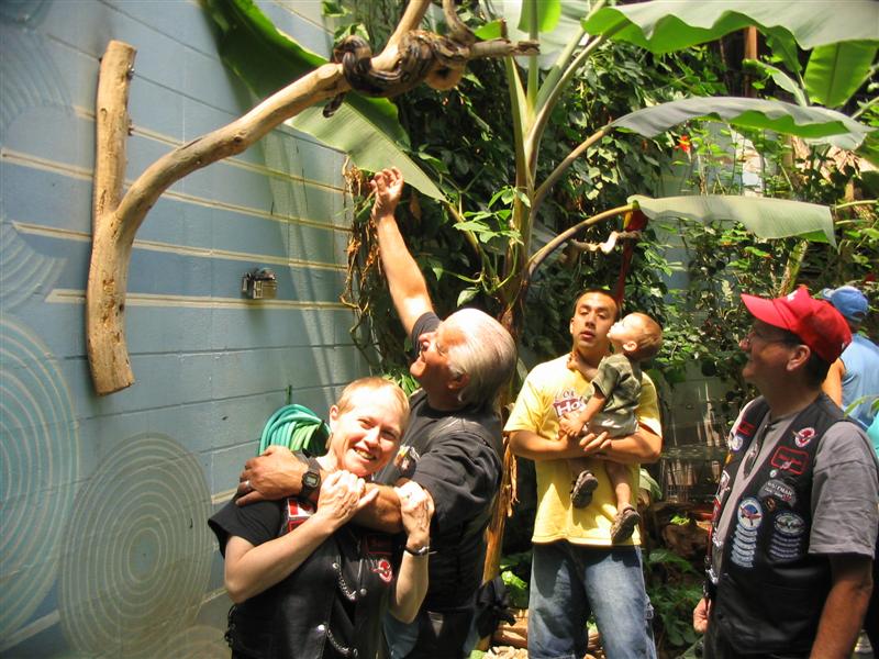 Sandy and I had visited Reptile Gardens in 1978 and had been impressed by the collection. This time, we saw almost every venomous snake I have ever heard of and a few I hadn’t. I got to see three different varieties of Taipan, one of which (the inland taipan or fierce snake) is billed as the deadliest in the world. There was also a Komodo dragon, the first I have seen live. There is a central dome covered area with exotic plants, some birds and the odd boa constrictor hanging around. It took some persuasion to get Sandy to pose under the boa.
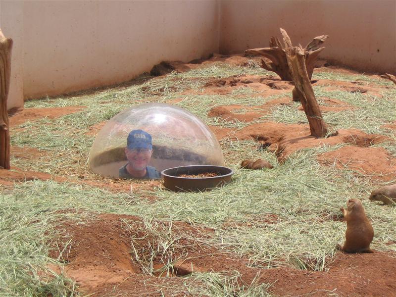 The young man doing the show with the alligators was funny. His routine was polished but delivered naturally. The most entertaining part of the place, however, was the prairie dog enclosure out back. Watching the little rats run around and interact with each other was, at times, hilarious. They even have a dome where, if you go down underneath, you can get a prairie dog’s eye view of the goings on. Sherm beat us to it.
We headed back south past Rushmore and into Keystone City where we stopped at a Dairy Queen for some Brazier food. We met a Vulcan rider from Minnesota who had never heard of VROC, so we talked a bit. Then we went across 244 and down 16 to the Crazy Horse Memorial.
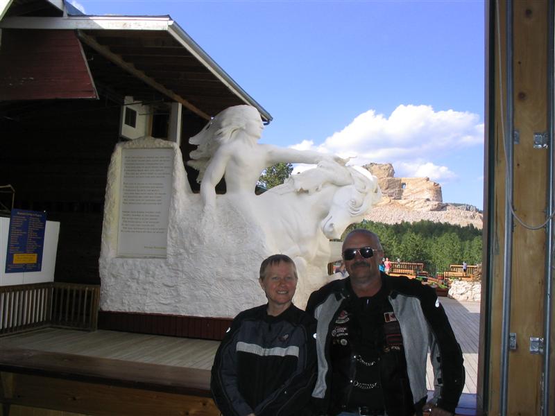 Crazy Horse has been under construction since the 1940’s. One man, Korsczak Ziolkowski, started working on this in the 1940’s at the request of Lakota Chief Standing Bear. His family continues the work to this day and it is expected to take decades to complete. The face is now visible. More information can be found at www.crazyhorse.org.
 On the way out, we met two more couples from Minnesota, one on a new Nomad. We had to chat with them for a while. Then we headed back to Custer, only four miles down the road. When we got to the Rock Crest, someone had provided coke and a variety of pizzas. There was, as usual, a donation bowl to cover the cost.
The GPS story got interesting here. We had been talking the first night about how it would be nice to have a GPS that showed Doppler weather on it. We wondered why this had not been done. It seems we were behind the times because Ham, of the Pacific NW, has a Garmin 376C on his new GoldWing and it does all this and more. It takes the weather info from XM Satellite Radio and is also a radio player itself. It costs about twice what a normal GPS does, but being able to see where the rain is would be priceless.
We socialized for a while and then they called us together for the group photo. Sandy got her moose hat so we should be able to pick her out. We should also be able to see quite a few Sherm’s. Then we got a picture of the Canadians, led by the very strong Alberta contingent. Then we went next door for pie. Sandy kept the moose hat on and got a lot of comments.
As the evening wore on, people slipped away after saying their goodbyes. Many will be at other gatherings this year so we’ll be seeing them again. This took the edge off the farewells. Finally, when there were only a couple of people left about midnight, Sandy and I said our goodbyes to those remaining and went back to the room.


No comments:
Post a Comment