Sunday, May 29, 2011

Freedom Riders Annual Memorial Run - Part Deux

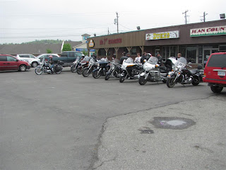
The day started out grey again but the radar showed nothing active in the area. We were out of here before 9:00 AM headed for our rendezvous spot at Mr. J's in Lively early enough to have breakfast before our 10:30 departure. A number of members were already there. We ate light as others arrived. By departure time, we had eleven bikes and fourteen people.

Bikes gathered at Mr. J's - Lively Ontario

Road Captain Nepper led us west on Regional Road 55 to Highway 17 and then south on to Highway 6 to Espanola where we stopped at Tim Horton's for our first break.

Tim Horton's - Espanola Ontario

The ride down the 30 miles of Highway 6 to Little Current, the gateway to Manitoulin Island, is one of the nicest in the area. Near Whitefish Falls, the highway runs around and over the La Cloche Mountains, passing through rock cuts of beautiful white quartz. This road was resurfaced recently and, while not technically challenging, is very enjoyable.

Leaving Espanola on Highway 6

Locals think this is a twisty road

Rock cuts abound

White quartz of the La Cloche Mountains

The 5th wheel was actually doing a decent pace

Pools and rocks near Little Current

Approaching Little Current, the single lane swing bridge onto Manitoulin Island, the largest fresh water island in the world, was closed. It normally opens for 15 minutes at the top of every hour to allow boats access to the harbour but we were lucky and just had to wait for a green light after the oncoming traffic cleared the bridge. This bridge is so much easier to ride across after they removed the railway tracks and timber deck, replacing them with asphalt. We stopped at the Visitor Centre where Nepper called ahead and found the restaurant in Mindemoya we had planned to use yesterday was closed on Sunday. Go figure. But there were other places to eat there so, after a suitable break, we motored on.

Swing bridge - Little Current Ontario

Visitor Centre - Little Current Ontario

We rode west and south on 540 to M'Chigeeng (pronounced shih-geeng), which means "village enclosed by stepped cliffs" although I will always think of as West Bay. There has been a move here to rename First Nations areas by their Indian names. I do wonder why they add the silent M to the front of many Objibway words but it is their language. But then again it's our alphabet.

From M'Chigeeng, we continued south on 551 past Lake Mindemoya, which contains Treasure Island. It is believed to be the largest island contained within a lake contained within an island contained within a lake in the world. Figure that one out. Soon we came to the village of Mindemoya where we stopped at Mum's Restaurant and Bakery. Sandy and I split a lunch special of chicken fingers, fries and coleslaw while I had a bowl of hamburger soup. On the way out, I bought two magic bars from the bakery counter for later.

Mum's Restaurant and Bakery - Mindemoya Ontario

Suitably fed, some of the bikes gassed up here and then we rode east on 542 through the village of Sandfield, which my Zumo knows nothing about. In fact, if you are riding Manitoulin, don't put too much faith in a GPS. Most establishments aren't in the database and mine tried to have me turn left on a dirt lane thinking it was Highway 6. We did turn north on the real 6 and then stopped at 10 Mile Point.

Ten Mile Point - Manitoulin Island

Motorcycles lined up for a group photo

This is one way to move a house

View across the mouth of Manitowaning Bay of Lake Huron - Manitoulin Island

Leaving Ten Mile Point, we rode back to Little Current, crossed the still closed bridge and headed back through the La Cloche Mountains to Espanola, where we stopped at the Esso station for more fuel.

More white quartz cliffs

Returning to Sudbury via Highway 17, we exited at Highway 144 and rode north to Chelmsford where we stopped at Nepper's house. His wife Yollande had skipped today's ride but made us feel at home on their fine deck. I'm not sure why we didn't take pictures because their back yard and house are beautifully done. Nepper is new to the Road Captain business but he is doing a fine job for the club and we welcome his efforts.

We left Chelmsford and rode home arriving in time for supper. All in all, it was an excellent day.

More photos here.

Today's Route: (245 motorcycle miles):


View Larger Map

Saturday, May 28, 2011

Freedom Riders Annual Memorial Run

The Annual Memorial Run has been a Freedom Riders tradition for many years. It is a time when the club gathers to remember those club members who are no longer with us. The focal spot recently has been a memorial tree to Founding Member Alex Ogilvy that was planted at Fielding Memorial Park by his wife Mary Ann and daughter Becky. To increase the profile of this run, the membership recently decided that it would be held on the last Saturday of every May.

After gathering at the tree and saying some words, the plan was to ride to Manitoulin Island for lunch but the weather didn't cooperate. This morning, we awoke to grey skies and steady drizzle so the ride was deferred until tomorrow but the Memorial Gathering itself was to go ahead rain or shine.. Some determined riders showed up at Fielding on bikes while more came in cars.

At the appointed time, President Rob said a few words followed by the Linda Ellis poem The Dash. I followed by reading the names of our fallen friends and a passage by Canon Henry Scott-Holland (1847-1918), Canon of St Paul's Cathedral titled Death Is Nothing At All.

Fielding Memorial Park

The Alex Ogilvy Memorial Tree

Note the umbrellas

Freedom Riders Group Photo

Afterwards, we mingled for a bit and then Road Captain Nepper, in his trusty waterproof  Jeep, did what he does best and led us to food. We all got to Mr. J's Roadhouse in Lively before he did.

Breakfast was good and we made plans for part two of the Run, the ride to Manitoulin Island for lunch tomorrow. We hope the weatherman is nicer to us then.

The group at Mr. J's

More photos here.

Wednesday, May 25, 2011

Mayor Proclaims Motorcycle Awareness Month In Greater Sudbury

For years, the Sudbury Chapter of the Harley Owner's Group (HOG) has arranged for the Mayor of the City of Greater Sudbury to issue a proclamation that May is Motorcycle Awareness Month. They announce it at a gathering in the courtyard at Civic Square. Up until now, Freedom Riders participation has been marginal.

We decided that this year would be different. A call went out to the members and a good turnout gathered at the CP train station in Sudbury at 5:00 PM. We rode as a group to Civic Square soon after and lined up alongside HOG, GWTA and a few others.

Sudbury's new mayor, Marianne Matichuk, joined us and, after some introductory words by Danielle of HOG (and also Freedom Riders), Her Worship read the proclamation naming May as Motorcycle Awareness Month in Sudbury and exhorting automobile drivers to exercise caution.

Motorcycles gathered in the courtyard at Civic Square

Her Worship Marianne Matichuk (on the pretty red Vulcan) and ladies

Reading the proclamation

Danielle of HOG, Mayor Matichuk and Freedom Riders President Rob

More photos here.

After the proclamation, Road Captain Nepper led the Freedom Riders to the Dog House Restaurant in Azilda where a few of the HOG riders joined us for supper. The food was good and our server, who handled 24 of us singlehandedly, was absolutely amazing.  "No problem", she kept saying, and it wasn't.

We also managed to make it home before the rains arrived, one of the key signs of a successful ride.

Monday, May 16, 2011

Trip Summary

Days on the road - 12

Motorhome

Distance traveled - 3,588 Kms (2,230 miles)
Fuel fill ups - 7
US Gallons consumed - 245.39
MP(US)G - 9.06
Mileage at end of trip - 116,107 Kms (72,148 miles)

Motorcycle

Distance traveled - 1,395 Kms (867 miles)
Fuel fill ups - 5
US Gallons consumed - 22.65
MP(US)G - 38.28
Mileage at end of trip - 230,723 Kms (143,371 miles)

Findlay Ohio to Sudbury Ontario

It was still raining and even colder this morning. We had breakfast, stowed everything and were rolling north into a stiff headwind by 6:30 AM. I noted that Ohio gas was still $3.89 per gallon despite dropping oil prices. It seems that when oil goes up, the price is based on what it will cost the stations to replace the inventory in the tanks. When oil drops, they price based on the cost of what they already have in the tanks. That inconsistent philosophy allows them to, as the Statler Brothers said in a song, have their Kate and Edith too.

North of Toledo, we could see the edge of the cloud system to the west with what looked like blue sky beyond it. This whole mess was the result of a large low pressure system stalled over southeastern Ohio. On the plus side, the last time we came through here it was snowing pretty heavily on us so this was an improvement. As we continued north, the rain abated although the headwinds continued.

Passing by Ann Arbor, a blue sports car passed us dragging its rear bumper. One lane to the left, the cover came off and slid to the breakdown lane. The driver must have been aware of it because he immediately pulled off on the side. He must have been quick because, after twenty minutes, he passed us again and the bumper cover was back where it belonged.

Blue sports car with reattached bumper cover

Approaching Saginaw, we stopped and short fueled so we would have enough gas to get to the Soo. I was dismayed to see we only got 7.8 MPG on this short stretch, possibly due to the raging north wind. I was intrigued by a billboard advertising the World Famous Cops & Donuts Bakery. This sounds intriguing enough that we'll have to stop there sometime. I also saw a sign for a Tim Horton's in Saginaw advertising free WiFi. I wonder when the Timmy's and Mickey D's in Canada are going to get a clue and offer this service?

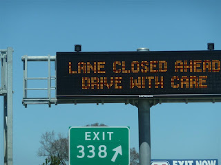
North of Saginaw, we finally ran out of the clouds into blue sky. There was a section of I-75 that was down to one lane with orange barrels galore. The scarified pavement in the travel lane was so rough I slowed to 45 MPH to avoid having the RV shake itself to pieces.

Blue sky, orange barrels and rough road in Michigan

From here north, there was very little traffic and, at times, we had the road to ourselves. Near Grayling, we stopped at a Rest Area in another construction zone (thank you, Barack Obama) and had lunch. We had the truck parking area all to ourselves.

As usual, the Mackinac Bridge was down to one lane, this time in three separate places. We were limited to 20 MPH as a truck took the heavy vehicle speed limit seriously. I paid the $4.50 per axle toll and we entered the Upper Peninsula.

Lanes closed again on the Big Mac

Hydrofoil to Mackinac Island

The bridge towers

Welcome to the home of the Yoopers

The radio was calling for frost tonight and I again asked myself why anyone would live here. When I was a kid in Timmins, I would see photos of people in Moscow all bundled up against the cold and would feel sorry for them. Later, I discovered they had a much more moderate climate than the one I was raised in. If it wasn't for the Ontario health care rules, I would move south in a heartbeat.

I fueled again in Soo, Michigan. The price was $4.209 but was still much better than what I would pay north of the border. Despite the continuing headwind, this tank yielded 8.6 MPG. There were only a couple of cars in the line and, with less than $100 to declare, we were welcomed home and sent right on through.

American Locks in Sault Ste. Marie Michigan

The St. Mary's Rapids (translation: Sault Ste. Marie)

The old International Bridge

No lineup at Canadian Customs

I would have liked to stop and see my brother again, but it was getting late and we wanted to be home before dark so we headed right out on Highway 17. Traffic was light as we moved along. After crossing the bridge, we heard a new clunking/rattling sound. Once the source of a rattle is found, I tune it out but before it is identified, I don't know if it is something benign or is trying to tell me that a wheel is about to fall off. This one was sporadic and Sandy had trouble pinning it down as she moved around the inside of the RV, listening carefully.  After we arrived home just before sunset, I found it was the CB antenna attached to an over cab window.  The mount had loosened and was tapping against the roof gutter.

We unloaded the bike, disconnected the trailer and used the van to move it into the driveway and then backed the motorhome into its spot. Another great trip was over and we still liked our little house on wheels.

Today's Route: (623 motorhome miles):


View Larger Map

Sunday, May 15, 2011

Maggie Valley North Carolina to Findlay Ohio

We weren't in a rush this morning. I wandered around saying goodbye to some of the people who were still here and waved as some of the riders headed out. We'll be seeing some of the people again next month at the Wolfman's Wandering Rally in Deadwood, South Dakota. We stowed the gear in the motorhome for travel and reserved the same pull through spot in the RV park for next year. It has been a very good week here in Maggie Valley.

I fired the big Ford Triton V10 up just after 9:00 AM and maneuvered carefully to be sure I cleared a large tree stump between our site and the roadway back to the street. There are some things that, done once, don't need repeating. Instead of going back through West Virginia, we turned off US 19 and headed over to I-40 west, putting us on a route that would take us up I-75 and back into Canada at the Soo.

This stretch of I-40 has some curves where the truck speed is limited to 50 MPH so we cruised along at a slow but steady pace under overcast skies. A semi tractor passed us with a Smart Car crosswise behind the cab and towing a 5th wheel. That looked like one serious traveling outfit but I wondered how they loaded and unloaded the car.

This stretch of I-40 passes through beautiful terrain

Houses on a hill near Knoxville

Just before Knoxville, we stopped at a Love's truck stop. It appears that people here fuel their cars and then leave them sitting at the pump while they go shopping inside. All the pumps were blocked by empty vehicles.  I got into the lane marked for RV's behind a large Winnebago diesel pusher. Again, after taking on countless gallons of fuel, the driver went inside for an extended period. When he came out and saw us sitting behind him, he gave me a sheepish look and got out of our way. Again, the 55 speed paid off as my calculations show we got 8.9 MP(US)G since the last fill up.

Connecting with I-75 in Knoxville, we started north up the same road we took back from Chattanooga. Before long, we encountered a light rain. By Lexington, Kentucky it had turned to a steady rainfall and the temperature was cooling. My thoughts went to Chuckster's group which had ridden out earlier and was headed up this same highway on their way back to Michigan. I turned the windshield wipers on, adjusted the heater and decided the RV life wasn't too bad.

I-75 North

Deja Vu all over again

Familiar Kentucky geological strata

Between the Kentucky Welcome Center in the south and one Rest Area near the Ohio line, there are no places to stop along the Interstate. I was getting pretty hungry before we got to the north end of the state and stopped for lunch. By now, the rain was coming down hard and it was much colder out even though this had all the earmarks of a warm front system.

We crossed into Ohio and, for a ways north of Cincinnati, the rain eased up. But, by Dayton, we were back in it and the wind switched 180 degrees and was now coming out of the north. At some points, it was raining hard enough to significantly reduce visibility. I found the Ohio hills to be steeper than those in Tennessee and Kentucky based on the way the transmission was downshifting as we climbed.

Another Cincinnati skyline shot from the Covington Hill

Somebody found something nice

Near Findlay, Ohio we stopped again for fuel. Despite the hills and the late headwind, we got a stunning 9.8 MPG. Taking a bit longer to get somewhere has its upside.

Findlay is known as Flag City USA according to words on an overpass as we got to town. Apparently this goes back to the 1960's and was the brainchild of a man named John Cooke who thought every home in Findlay should fly an American flag on Flag Day (June 4th). It is an interesting story.

We found a WalMart beside I-75 and, as dark was falling, we pulled in and found a level spot away from the building. This lot was also posted but only prohibited overnight semi parking. I went inside and asked anyway and Customer Service assured us we were welcome. We bought some groceries and then braved even colder rain back to the motorhome where we ate supper and watched Celebrity Apprentice on TV. Hoping for better weather tomorrow, Sandy put the down comforter on the bed and we turned in for the night.

Today's Route (502 motorhome miles):


View Larger Map

Saturday, May 14, 2011

Maggie Valley: Wedding Day

Most of my clothes and gear were still wet this morning. It was overcast with a forecast of thunder showers later in the day. After all the great days this week, why now? I sorted and entered bills and did some blog work, although I am not doing nearly well enough at keeping up lately. The more I have to do, the less time I have to write about it.

We spent the morning planning and waiting. I tapped Willie Wonka and The Lovely Carlene to help with traffic control at the overlook and enlisted Lucky Al to block the Parkway when the time came to pull out. Finally, I put on my new white shirt and my old black vest.

Judge, Wild Rose, Renata, Phin and Flip waiting for things to begin

KT, the blushing bride

Someone said I clean up well (thanks, Teri)

Silk flowers since real ones aren't allowed on the Parkway

The advance group, consisting of myself and Big Jim as groomsmen, Wonka and Carlene as traffic control and assorted friends were ready to leave at 1:00 PM sharp. The groom and best man elected to go with us so we headed out with Cheap Bastard and Wanda leading Wrong Turn and the rest of us to Soco Gap and then northeast on the Parkway. Although CB set a moderate pace, we became spread out on the 26 mile ride to the Cowee Mountain Overlook at Mile Marker 430. As we neared our destination, the phone rang. It was Sandy from the bridal car wondering which way they should have turned on the Parkway. They had a 50% chance of getting it right but didn't and were headed towards Cherokee. As they were turning around, Sandy told me Jax had led the main group out of Maggie Valley on schedule.

We arrived at the Overlook and got ourselves organized. Not a moment too soon as Jax and the crew arrived soon after and we got them lined up to allow for the smoothest departure after the ceremony. A few wandered in by themselves afterwards and we added them to the line.

Willie Wonka and The Lovely Carlene ready to control traffic at the overlook

The bikes lined up

Dark clouds on the horizon

Once the bride and her attendants arrived, we lined up for photos. Then Rabbi called us together and, with the Cowee Mountains as a backdrop, gave a brief but moving ceremony after which the bride and groom exchanged vows. They also exchanged the rings we had hunted for all over Tombstone. Congratulations were cut short because a weather cell was moving in and would certainly hit the Parkway on the route we were taking back. Stewey and Ronda headed out first to get to a site he had picked to photograph the group on the way back.

I don't have any photos of the ceremony but others.

Stewey's Photos   Kudzu's Photos   Kudzu's Video   Yummy's Photos

The bride and groom took time to don rain gear for the ride back. Most of us didn't. There were a few wrinkles getting rolling. The Parkway got blocked before the group was ready to roll but, luckily, there was little traffic. Then, as soon as leader Jax got rolling, three Harley riders (friends of the groom but not VROCers) came around the group and inserted themselves ahead of the bride and groom. But we got moving as one group until we hit the rain and the Milwaukee Vibrators pulled off at an overlook. Watching in my mirrors, I saw most of the group pull in behind them while Jax continued to lead us onwards. The rain wasn't bad and, despite wearing no rain gear or even a jacket, I was barely damp when we came out the other side. Unfortunately, when we got to US 19 where Kudzu was set to block the road to allow us access as a group, we were down to about twenty bikes. Back at the Applecover, the rest of the group straggled in after us (except a few who hightailed it around from Balsam Gap on US 74 and got there first).

All in all, the wedding was a joyous occasion celebrating the joining together of two of the nicest people I know and Sandy and I were honoured to be able to share in the day.

Soon after we got back to the motel, it was time to gather for the annual raffle. Everyone bought tickets and many prizes provided by Kawasaki USA, as well as solicited or donated by members, were up for grabs. We started slowly but picked up four prizes before the drawing was over. Finally, the proceeds from the ticket sales were split 50/50, with the final ticket pulled getting half and the remainder donated to the local DARE program. Deputy Heidi was on hand again to accept the donation while Paul (of Gixxer on the wet Parkway fame) won the rest.

The multitudes assembled for the draws

More multitudes

Jax, master of the raffles

When the raffle was over, we lined up for the supper put on by Derrick and Amy, proprietors of the Applecover. Before the food was ready, the bride and groom cut the cake and then Rabbi filled out the necessary paperwork so the government would say the marriage was legal. There was a question about what county and township the Cowee Mountain Overlook was in but Deputy Heidi made some calls and got an answer.

Rabbi does then paperwork to make the wedding legal

Doesn't Cheap B look distinguished?

When the food was ready, we proceeded through a line being served by Wonka, TL Carlene, the infamous Wompus and Saint Montene. We had a choice of pork, chicken or a brat, two sides and a brownie. Plus wedding cake.

After supper, the evening was quiet as is usual on the last night. Many people are planning to get up and leave early and goodbyes are usually said before going to bed. We didn't stay up too late and made the rounds before turning in. We'll be seeing some in Deadwood, South Dakota in about a month.

This has been a great week. Many thanks to Jax & Gale, Tina, Derrick & Amy, Kawasaki and all the people who pitched in to make sure everyone enjoyed their stay here. Others, with more aptitude and skill than I have, took photos throughout the gathering and posted them. Those people included Stewey, Blondy, Flamekiller and Tina. I'm attaching the links not only for your viewing pleasure but mainly to provide a way for me to find them later.