Monday, July 31, 2006

Caught Up

Sorry it took so long to get the Topaz and return trip posts up. There is a form of letdown I get after returning from a trip and I just got free of it today.

Now I have a whole list of things I need to do. Some by tomorrow, some by the Freedom Rally here this weekend (I'm Treasurer), and some before we leave for Interlochen and (probably) Pennsylvania later next week.

For those following Sherm's escapades, he has put the 900 Vulcan up for sale and bought a used '03 GoldWing from a VROC member. I knew he'd do it:-) He's already flown to San Jose California, picked it up and ridden it home. As usual, he has kept a photoblog of the trip. It's hard to keep a good man down, but it's IMPOSSIBLE to keep Sherm down.

I'll post a Freedom Rally report after the weekend and then we should be back on the road soon after. Until then, keep your stick on the ice.

Wednesday, July 26, 2006

Topaz Lake Nevada to Sudbury Ontario (Four Days)

Sunday July 23
My alarm watch went off at 5:30 AM and we hit the ground rolling. As we loaded the gear on the bike, the Sublows and a few others were also preparing for an early departure. VSP was wandering about saying goodbye and taking some pictures.

We were underway shortly after 6:00 under an overcast and spitting sky. Just north of Topaz at Holbrook Junction, we took SR 208 that would take us east and then north through Yerrington to I-80. We met several groups of vehicles, trucks and buses, about 50 in all. From the markings, it was obvious this was a firefighting camp on the move.

Out of nowhere in this flat land, there was a small cluster of mountains. The highway followed what appeared to be the Walker River through a canyon cut in the centre. We were surprised by a mule deer (again right at a deer crossing sign) and a jackrabbit with huge ears. Once out of the valley, the level land was being irrigated and farmed and we also saw the familiar tailings of a large Anaconda Copper operation at Yerrington. This was a pleasant little road.

On I-80, we turned east and picked up the pace. We continued to meet clouds and light sprinkles of rain. Crossing Nevada in the heat, this is generally a good thing. Several full patch Hells Angels and some unpatched companions passed us. The full patch riders waved, but the others just stared straight ahead. Typical. We lost an hour as well as the cloud cover at the Utah border. The Salt Flats were about 105F according to my GoldWing ambient air temperature gauge. The mountains looked like they were floating in water but I knew it was a mirage since there was nothing between us and them but white salt.

The 105 continued through Salt Lake City but cooled off a bit as we climbed out on the east side. We stopped just across the border in Evanston Wyoming at the same Comfort Inn we stayed at on the way out.
Today's ride - 687 miles.

Monday July 24
We were rolling at 6:15 Mountain Time. It was cool with a tail wind. It got cooler as we approached Green River. I don't remember Rawlins Wyoming on the way out but I do remember the Shell station where I fueled. A well meaning man at Mickey D.'s suggested we avoid Cody (not on our path) because of a Hells Angels gathering there. Turns out this was their World Run.
In Nebraska, the wind changed and was from the east. Not fair. I was looking for the prevailing westerlies to push us. The temperature only hit the high 90's, but it was more humid and more oppressive.
We stopped in Kearney Nebraska for the night. The Travelodge that offered 'The Best Deal In Town' had obviously overbooked based on the fiasco in the lobby, so we went next door to the Interstate Inn and got a clean room with WiFi for the best price of the trip.
Today's ride - 680 miles

Tuesday July 25
We got a late start due to rain over Grand Island. After a pleasant chat with the motel owner, we were rolling at 7:00. Almost at once, we lost another hour as we entered the Central Time Zone.
The clouds threatened north of us, but never got down where we were. Passed a Ducati Racing Team truck. Saw a couple on a HD that we passed. We met them three more times in rest areas. They were from Muskegon Michigan and were returning from Arizona.

In Lincoln, I-80 was blocked so we had to go to a secondary road around the trouble. The police had the detour well controlled and we had little trouble. Twice I passed a Utah Mini-Cooper with a young lady and a big dog. We met her again in a rest area and found she was making the run from Salt Lake City to Wisconsin. This was her second trip of the summer.

Met a group of at least 40 Hells Angels westbound. You can tell when its them in a group because of the tight formation and the riding discipline. These didn't wave. We knew now where they were headed.
At Des Moines, we headed north on I-35. Met a couple from near Duluth on an ST-1100. They had been riding with friends on a Wing towing a trailer until the GW had a rear blowout in a curve in a contruction zone with concrete barriers and crashed. I looked at my new tire.

We turned east on I-90 and I was hit with a wave of fatigue. This often happens to me riding Interstates. We stopped and I found some bottles of Starbucks iced coffee that I loaded into the Butler Mug. Tasty and effective when combined with a short break.

We arrived in Lacrosse Wisconsin and found an Excel Inn. The WiFi gave me fits. I spent the evening arguing with a SkyWiFi techie in Vancouver BC about whether it was their fault or mine.
Today's ride - 629 miles

Wednesday July 26
There was heavy rain overnight. Morning Doppler showed a large storm south of us heading east to Milwaukee. Good thing we were headed east and north.

Quicksilver turned over 70,000 Kms (43,500 Mi.) in this stretch. Not bad for an '05.
In Oshkosh, we found it was the Experimental Aircraft Association weekend. Had we pushed on, there would have been no rooms. Headed north through Green Bay. Lost another hour below Escanaba. Riding into Escanaba, there was a large black cloud ahead of us. Luckily, it pushed out over Lake Michigan just before we got there. The streets were very wet.

Continued up onto US 2 and east towards Manistique Michigan. Another big cloud ahead and north of us. I considered heading north, but this one wasn't eastbound. It was southbound and hooked down, effectively pinning us. We saw a waterspout out over the lake and looked for cover. Lucky again the Emerald City Espresso Cafe was in an old gas station that had an overhang out front. As it started to pour, we ducked under it, parked and had lunch. Great homemade bread.

After the rain past, we headed east on 2 and north on SR 117 to Newberry and east again on SR 28. As we approached I-75, there was yet another black cloud in our path. We turned north to the Soo and Canada just before we reached it. The UP always seems to have menacing weather.

From the International Bridge looking east, the direction we were heading, it looked grim. Black clouds boiling and roiling. I wanted to stop and say Hi to Mom but it was already 5:30 and the rest of the day looked rough. The border guy passed us through without ID (again) and we stopped at Timmie's to put on rain suits. The photo is for Don. He'll understand:-)

The funny thing is that we never needed the rain suits. I don't know where the black clouds went but it was not a bad ride home. Considering the weather around us, I'll ascribe our staying dry to The Luck Of The Irish. We got in about 9:00.
Today's ride - 725 miles

Trip Summary
Total trip miles - 6,180 miles in 17 days
Average MPG - 42.0 MPG (US)

Saturday, July 22, 2006

HSVROC Summary

High Sierra VROC was a blast. As I told someone at the raffle, it was well worth the over 6,000 mile round trip to be there.

I need to thank those responsible for putting this on and giving us a place to gather.

Don 'VSP' Inamasu was the ringleader, overseeing the event with a master's touch. Thanks, Don, for all you did and for taking all that time to show us YOUR California.

What can I say about the Sublows. Howard, Linda and kids were always there giving of themselves to make sure others were looked after.

Slots, my old friend. Thanks for leading, looking out for us and also for treating us to supper in Reno. We look forward to our next meeting.

Mario and Linda, you may be new but you showed the Spirit of VROC. It was a pleasure to meet you and I am sure we will be seeing you again.

To the others who planned, worked, donated and led, I offer our gratitude. And to those who made the trek to this corner of Nevada to share in the camaraderie of our extended VROC family thank you for being there. It was a weekend to remember.

Don was kind enough to link all the HSVROC Blogs onto one page. You may have seen some of them, but others will be new. I wish I would think to use my camera the way these people do.

So that's it for HSVROC. Until the next time.

Topaz Lake Nevada - Monitor Pass Redux and Genoa

Sandy and I decided to try the ham steak this morning for breakfast. One order shared between both of us should be good, we thought. The ham came on its own plate and both of us weren't able to finish it along with the toast, eggs and potatoes. It was, however, a very good value.

Today I had a very modest goal. Other rides were heading for Tioga Pass in Yosemite Park, Lake Tahoe or Mono Lake to the south. All I wanted to do was confront Monitor Pass again and get the worries I had been harbouring since my very stiff descent on Thursday out of my system. It turns out I would have company as good old NiteLite (with his daughter Laura Anne on back) volunteered to lead and his son Brian, Cranky, Sherm and Lisa and Gary "Cash Kaw" Jones decided to go along for the ride.

We headed south on 395 a few miles and made the turn on 89 towards the pass with Howard in the lead, Gary second, us third and the rest of the crew arrayed behind us. The first little stretch was through a small canyon and across the valley floor to the start of the climb. My pulse quickened as we rode but I thought positive thoughts. What I discovered as we approached the grade was that it looked a whole lot different from the bottom. Instead of sheer drops, the ground sloped away from the road although this wasn't apparent when going down. Instead of being faced with a 2,500 free fall, it would only be a 2,500 foot tumble. For some strange reason, I had no problem with that:-)

Howard set a relaxed pace as we started the climb out of the valley. This time, I was relaxed even though most of the time we were on the outside next to the edge. I found myself wishing we could pick up the pace. Before long we were at the top. In the last turn to the left onto the plateau there is no road visible ahead of you or to the right and, as Slots says, it is like you are flying for a moment. Then we were in the high meadow and I had faced down another self inflicted demon.

As we rode across the high desert, Sandy pointed out a coyote. It took me a couple of looks to pick him out as he slinked away from us in the sagebrush while looking back over his shoulder reproachfully. He didn't seem thrilled that we were invading his space. We continued on and started to wind our way down, passing the Highway 4 turnoff to Ebbetts, and continuing along the river to Markleeville.

Markleeville is about two small blocks long, but it is the county seat. There is one restaurant that used to be biker friendly but was then taken over by Yuppies who tried to cater to a different clientele. They have changed their tune, but we avoided the place on principle. The Deli across the street looked closed, but someone was at the door and said they would be opening in five minutes. Excellent timing. Some of us had ice cream, some had other things and we sat on the shaded deck and talked a bit.

The Sublows elected to return to Topaz over Monitor while the rest of us decided to go on. Brian later told me that he had a better understanding of my attack going down the grade since it looked entirely different from that direction.

The crew going on decided we would go to Genoa. Since I had been in Markleeville three times in the last ten days, I was nominated to be leader. I set a leisurely pace on Highway 89 and hung a right on 88 towards Gardnerville. Without aid of a map, I made an instinctive left onto Foothill Road and we wound our way along the base of the Sierras, always taking the road nearest the mountains. There were several bicycles, including a couple of young ladies who were riding two abreast and taking up our entire lane through a semi-blind curve. A pox on them. I also almost rear-ended a truck towing a trailer when he slowed suddenly to turn while I was looking ahead for a passing spot. A wake-up call, since it would have been entirely my fault.

GenOa. That's how they say it. It's home to the Genoa Bar, "Nevada's Oldest Thirst Parlour". This place has been in business since 1853 and currently boasts a strong motorcycle following. There were a lot of bikes out front. To our surprise, there was also some sort of cruise-in happening and both sides of the street were lined with a variety of classic and vintage automobiles. We walked up and down admiring them until the sun, which was now overhead and quite oppressive, made us seek the shade.

On one corner down the street from the bar, there was a pretty little park. There was a statue there dedicated to John 'Snowshoe' Thompson. Despite the name, Thompson brought his knowledge of skis from Telemark Norway and, using a pair ten feet long, carried the mail over the Sierras from Placerville California for twenty winters in the mid-1800's. The picture of Sherm in front of Thompson's statue is appropriate because I believe they share the same indomitable spirit.

After the visit to the park, we stopped at a small restaurant across from the bar where some of us had sandwiches. Gary opted to leave us at this point and head back to the Lodge while we continued on up Jack's Valley Road. As we left Genoa, two mule deer came bounding out of a yard and around a hedge. One crossed in front of me and the other stopped, as did I. Sherm noted that this was right at a deer crossing sign. Since the second deer didn't seem to want to commit, we eased forward until we were past them. Once again, my deer encounters happen about noon. Jack's Valley Road met 395 just south of Carson City and it was then a straight shot back to Topaz with a gas stop in Gardnerville. Funny but it was the same three bikes as yesterday.

Back at the Lodge, Sherm installed a set of foam tunnel fillers he took off Kokopelli on Quicksilver. These block rain and dirt from coming up inside the fairing through the opening around the fork legs. They have over 80K miles on them but they work just fine and it pleases me to know that a part of that noble motorcycle rides on with me. Thanks, Sherm.

At the Lodge, we spent some time talking with Mark 'Grumpa' McGillis and his lovely wife, Debbie who were in the room next to us. Sandy and Deb had already spent time talking about our Joe Rocket Alter-Ego jackets and Sandy's Gerbing heated jacket liner. It seems both of them are the same size so Deb now knows what sizes she wants. The sun continued to be hot and I got a picture of Sandy making use of the A/C in the room while still conversing with the folks outside. We then went over for supper with the Grumpas and Chuck 'Mac Guy' Noll.

After supper, it was time to head over to the pitch for the HSVROC Raffle. While many donated prizes to this, the prime movers were the Sublows, with Howard chasing many businesses to ante up. The net proceeds from the ticket sales, after the 50/50 prize, were to be donated to fight breast cancer.

The assembled crowd eagerly awaited the drawing. The prizes, large and small, were selected one at a time and then a name was picked from the barrel by Bikerdad's young daughter. We went along for a while and then won a prize. And then another. And another. When the final tally was in, we won three shirts, a pair of leather gloves, a hat and a leather tool pouch. We gave a couple of things away, but the shirts and gloves got packed. The 50/50 draw, worth over $500, went to GypsyCat, a very interesting lady from the Pacific NorthWest. An excellent showing, many thanks to the Sublow Clan for all the hard work.

After the raffle, some of us wandered over to the Casino for a while and then sat outside and watched heat lightning flash over the hills across the lake. Then it was time to turn in since it would be an early morning tomorrow.

Friday, July 21, 2006

Topaz Lake Nevada - Virginia City

Slots lost a bet this morning. Last night, as it was raining, he bet Sandy a dollar that it would be clear and dry this morning. As the light rain misted, he agreed that (since he had already won another bet) they were now even.

We had breakfast in the Lakeview Room. Sandy and I tried to eat light but Cat ordered the Ham Steak and had so much meat that she had to split it with Bikerdad. We then adjourned to the parking lot where the main group, the one Slots was taking to Virginia City, got its instructions. Others were going farther afield but Paul wanted to get us back before 2:00 PM when he figured that the storms would kick up again. You can see that the riders are giving him their complete attention as he lays out the riding instructions.

The group left as close to 9:00 AM sharp as was possible. There were about 19 bikes and we were about eighth from the front. As we went up and down the hills on 395 north of the Lodge, it looked great. For some reason, VROC groups usually seem to know the fundamentals of group riding. We did well until Carson City. After making the right turn on US 50 in the middle of town, the first seven bikes made it through a traffic light leaving Caddman and I at the head of the rest of the pack looking at the big red eye and watching our leader disappear in the distance. The cross road went to the airport and they had a lot of time to get through since it was a very long light. Then the turn arrows kicked in. Finally, the light turned green and I, the lost leading the lost, took the point. I could just vaguely make out some specks in the distance that might be our lead section, so I pressed the speed limit a tad. Until we caught the next red light. This proved shorter and then we were out on the four lane road so I picked the pace up again. The dots got bigger and it sure looked like our people. Eventually, as we were gaining on them and crested a hill, I looked down and saw the speedometer was reading 135 KPH. That would be about 85 MPH in the local units. About this same time, the corner of my eye caught a sign that said 45 MPH. With visions of Nevada jail cells dancing in my head, I scanned for blue lights as I simultaneously tried to slow down and make myself invisible.

We did catch the group, a little slower than would have happened had I not seen the sign, just as they made a left at a sign that said, of all things, Virginia City. It looks like we could have found our way after all. This road led us on a winding path through hills covered with yellow grass through Silver City and Gold Hill and up to the famous Virginia City, where Sam Clemens first used the name Mark Twain. I looked for the Cartwrights and Sheriff Roy as we rolled into town, but the only steeds in evidence were our own magnificent two wheelers. We were lucky to find a long parking space at the end of town.

Virginia City feels like what I expected. Many old wooden buildings housing a combination of the usual tourist traps and some points of historical interest. In the heart of downtown, we stopped in at the famous Bucket of Blood Saloon where Slots, bless his heart, started a tab for those wishing refreshments. Some bought T-shirts and other souvenirs and, just before we left, a banjo player started up accompanied by a player piano. That really added to the atmosphere. On the way back to the bikes, Sherm and Lisa tried to find a place to get vintage pictures taken but the lines were longer than they wanted to wait.

Back at the bikes, Sherm, Lisa, Sandy and I headed back towards Topaz. Sherm was starting to feel a bit tired. Hell, I was tired and I wasn't in a major wreck two months ago. I took the point and we rode back down the twisty road to US 50. As I turned on 50, I noted two things. We had picked up another Vulcan (who I later found to be Bill "Cranky" Snodgrass) and, in the stretch where I had been moving at 40 MPH over the limit, there were now a Nevada State Police car and another trooper on a BMW bike. Looks like it was my lucky day.

The ride back was mostly uneventful. Sherm did find at one point that the 900 doesn't pass quite as fast as the Wing, which gave Cranky and I a scare, but Sherm only laughed. Back at the Lodge, Mario and Linda had the hot dogs on. These are new members from the Tahoe area and the way they threw themselves into co-ordinating the food and beverages was nothing short of outstanding. The lines of bikes in front of our part of the hotel grew as the various riders wandered back in from their various explorations. At 2:00 PM, against all predictions, the skies were clear and some members immersed themselves in the pool.

All afternoon, we watched storms roll in from the east and skirt us on the north side with some very active lightning displays as I am sure they were drenching Carson City. Finally, about supper time, it was our turn and the downpour ensued. This was followed by a rainbow over the lake, which I managed to capture half of. We didn't pursue the pot of gold.

We had supper with Jim Siegelaar, our smiling Canadian brother from Lundbreck Alberta. Then we adjourned to the bar for a bit where Slots, Jack 4E and Mario picked up some rounds, and then we headed back out to the tables by the horseshoe pitch for more visiting. It's amazing how quickly things dry out here after the rain ends. After dark, Sandy headed to bed and I returned to the bar with Barb, Jack and a few others. In the photo, Cranky is helping the singer while Barb 4E looks on in wonder. When my turn came, I wish I had known the song but, after a couple of drinks, I really didn't care. Shortly thereafter, security asked if I would be good enough to stop taking pictures in the Casino. No problem, and I should have known better anyway.

Shortly after midnight, I decided to hit the hay and wandered my way back to our room.

Thursday, July 20, 2006

Stockton California to Topaz Lake Nevada - HSVROC

The day dawned hot and clear in Stockton, as usual. We packed and loaded the bike while Don moved the motorcycles of his fleet around in the garage. He is riding his 500 Vulcan (not pictured) to Topaz. We set out north on I-5 and stopped for gas and breakfast at the Lodi exit. After taking back roads around Lodi, we connected with SR 88 and started into a few curves in the foothills.

Don took us on a side trip up to the viewpoint above the Pardee Dam and Reservoir. It was 95 degrees in Jackson as we started to climb amidst moderate but not very fast traffic. In one little town, we got behind some moving trucks moving a few miles up the road at around 20 MPH, which caused a major traffic jam behind us.

We stopped at the Peddler Hill Overlook for a break and a beautiful view of the Sierras. When we got going again, all the other traffic was gone and our run up through Carson Pass (8,573 feet), named for scout Kit Carson, was undisturbed. The road was composed of big sweeping turns and was fun to ride.

Instead of following 88 into Gardnerville, Don turned right on SR 89. This was the way we accessed Ebbett’s Pass last week, but this time he stayed on 89 after Marleeville instead of taking SR 4 to Stockton. The road took us on another winding route through Monitor Pass (8,314 feet). All was well until the last few miles when the road descended about 2,500 feet in three miles. I made the mistake of looking down into the valley at the top of the hill. There appeared to be nothing beyond the edge of the road but a sheer drop with no guardrail. This caused me to tense up and have the first uncontrollable panic attack in over a year. I made it to the bottom but the descent was not any fun.

At the bottom, SR 89 connected to US 395 where we took a left. After a couple of miles, Topaz Lake and Topaz Lodge came into view. At the Lodge, I thanked Don for going down the grade slowly out of consideration for me. He said he always came down that hill at the speed. We checked in and took our gear up to our room.

You may recall back in May that I told about our friend Sherm and the wreck he had in Oregon. Well, you can’t keep a good man down. Sherm was here with his new 900 Vulcan. He towed it down from Coos Bay behind his little Toyota pickup truck, but he was here and looked remarkably well for someone who was in ICU less than two months ago.

We went to supper at the Lakeside Room in the Lodge with Jim Siegelaar of Alberta and Slots. The windows afforded us a great view of the lake and the torrential downpour that struck right after we were seated. It was nice that it didn’t happen while we were riding the passes, but others weren’t as lucky. After supper, the crew gathered in front of the convenience store trying to stay dry while we visited. Then, after it stopped, we moved over to the picnic tables near the horseshoe pitch and continued the conviviality until we went to bed.

I’ll leave you with a shot of the sun hitting the top of the mountains across the lake as it went down behind us.

Wednesday, July 19, 2006

Stockton California - A Down Day

Today, we didn't leave Stockton. Sandy left with Don to take our laundry over to Leona's while I worked on a couple of days of Blogs. They came to get me for lunch at a Mexican Restaurant in downtown Stockton. Sandy has avoided Mexican in the past, but Don showed her some dishes that weren't spicy. Here we have Don's father Frank and Mom Leona, Sandy, Don and Michiko, a family friend. Michiko was born in Vancouver, grew up in Japan and then moved to the USA. She'll be going back to Japan in September to visit her mother, who is 102 years old.

After lunch, we drove around Stockton and visited some Hispanic stores, one big grocery and a small grocery in search of Jelly rolls. Then it was home for more blogging while Don worked on getting ready for High Sierra VROC.

Supper was at Carl Jr's, a hamburger chain I've never been in before.

This time in California has been very educational and enjoyable thanks to Don. His hospitality and tour guiding allowed us to see so much more than we would have been able to discover on our own. Thanks, Don, for everything.

Tomorrow we head over the Sierra's to Topaz Lake. Since the Topaz Lodge has still, apparently, not embraced the WiFi revolution, Blog updates may be sporadic for the next few days. If I am able to dial in to Carson City like I did last time, I'll be able to get the reports out. If not, I'll get them posted as soon as we get to a connection.

Tuesday, July 18, 2006

Stockton California - North Coast and Napa Valley

Again the day started warm with a forecast of very hot in Stockton. Don assured us it would be much cooler on the coast this time.

It was a familiar ride north and west across the delta to Rio Vista. Beyond there, we passed another substantial windmill farm. I continue to be amazed by the amount of wind generation California has.

In Fairfield, we stopped at the Jelly Belly factory. I've been familiar with these very tasty and quite expensive little jelly bean candies for years but I had no idea that the factory was also a major tourist attraction. The large parking lot even had a separate section for RV's. The plant was named "Best Factory Tour in America" but the line-up for the tour was longer than we wanted to wait. Instead, we wandered the store and ended up buying a two pound bag of "Belly Flops", beans that didn't make the quality control cut. They are a bargain and taste just as good. The problem with a two pound bag is that you eat them too quickly. The factory is also a popular meeting place for the Northern California VROC rides.

We went north and caught Wooden Valley Road to SR 121 and then SR 128 in a loop that brought us out on the Silverado Trail in the Napa Valley. These roads would be every bit as good on a motorcycle as the better known routes in North Carolina and South Georgia. At the corner of 121 and 128 there is a store known as The Corners, a popular bike hangout. The sign said "Closed Monday For Cleaning". It was Tuesday and the place was still closed but we talked a bit with two pilots, one from Vacaville and the other from near Concord New Hampshire, who were taking a break from riding their sportbikes in the area. North of there, we stopped at the open store at Turtle Rock for water.

The drive through the Napa Valley past wineries known for their reds was pleasant. We cut across Petrified Forest Road, Porter Creek Road and Mark West Springs Road where we caught River Road to Guerneville along the Russian River. Continuing on, we went south through Monte Rio, home of the exclusive Bohemian Grove where the powerful gather, and down the very tight Bohemian Highway to Occidental through beautiful stands of redwoods.

In Occidental, we were met by Howard 'NiteLite' Sublow, a VROCer from Petaluma who was born in Montreal. We'll see Howard on Friday at Topaz, but he drove up in his Jeep to have lunch with us at the Negri Occidental Hotel dining room. The Occidental has been owned and operated by the Negri family since 1893. They tell me that the family also owns most of the rest of Occidental. I was surprised by both how good the food and service was and how reasonable the prices were. Sandy and I had chicken parmesan and Don had duck which, as usual, wasn't on the lunch menu.

After lunch, we drove the Coleman Valley Road over to the coast. Since they said we both needed to see the view from the front seat, Sandy went with Howard in his jeep. He led since he knew the road better. We immediately left the valley by hanging a right out of the Occidental parking lot and starting what seemed like straight up. The road wound through redwoods, periodically coming out in the open. At the top, it opened up and we had a great panoramic vista of the rolling hills along the coast. The Pacific came into view and then we were starting down to the coast. And I mean DOWN.

At the bottom, we turned south on Highway 1 past beaches loaded with surfers, swimmers and sunbathers. We stopped at the parking lot above Salmon Beach where I got a picture of Sandy. I told Don and Howard that my father's home on the North Shore of New Brunswick was also Salmon Beach so I felt right at home. Howard left us to head back to Petaluma and we continued south on Highway 1 through the town of Bodega Bay, the setting for the Alfred Hitchcock masterpiece, The Birds. We then followed the road inland to Bodega.

In Bodega, we took a side road to an old school. This building was used in The Birds but, with the use of cinematic magic, they made it appear to be in Bodega Bay. There was a younger couple from Minnesota there and the man was trying to get just the right angle for a picture. Although the location wasn't marked, another car of Hitchcock fans pulled up before we left.

The next stop was in Freestone for some bread. The bakery was closed but the Freestone Store, established in 1876, had some. They also had an interesting selection of wines in a rack at the back.

From Freestone, we went through Sebastopol taking back streets to dodge what was now rush hour traffic. We continued on the Santa Rosa and negotiated back streets to the Charles M. Schultz Museum. Almost everyone knows that Charles Schultz was the creator of the beloved Peanuts comic strip. We were too late for the museum but the gift shop was open and had some interesting things. Strangely, the parking lot for the museum and adjacent skating rink was extremely full.
In the store, Snoopy is seen gunning for the Red Baron. The name Capt. Roy Brown is painted under the cockpit. Brown was the Canadian who was officially credited with shooting down the Red Baron, although this has since been disputed. Sandy had a chance to rub noses with the world's most famous dog and we found that the arena was hosting the World's Seniors Hockey Tournament which explained all the cars. I saw some Canadian teams on the schedule but none from Ontario.

We fought our way through Santa Rosa traffic and left town on SR 12 into the Valley of the Moon. This had more vineyards and wineries on the way down to Sonoma. We passed the gate of the Smothers Brothers tasting rooms. Don said this valley has more white wines compared to reds from the Napa.

Sonoma was a treat. We got there about 6:00 and found a large number of people gathered in the town plaza. There was a farmer's market and music and dancing. Families were picnicing or just sitting and watching. The shops laid out around the plaza and the lanes were immaculate and there were many people of all ages wandering around. It felt much like the downtown in Lodi, very much used and appreciated. We found a shop in an alley that had Hawaiian ice cream and gelato and ate some sitting at a table outside.
In the plaza, there was a statue commemorating the Bear Flag Republic. It was on this site in June 1846, on the verge of hostilities between Mexico and the USA, that 33 men hoisted the Bear Flag and made a declaration of independence from Mexico. The new republic lasted for 25 days and then, when hostilities broke out, the Bear Flag was replaced by the Stars and Stripes. An updated version of the Bear Flag is now the state flag of California.
The drive home from Sonoma was uneventful. We did get to see a C5 transport flying what looked like touch and goes as we went by Travis AFB.
Once again, the day was warmer on the coast than predicted. NiteLite agreed with Don that this was unusual, but I am beginning to have serious questions about this.
I turned in early after one more day filled with exploration of California. Tomorrow will be a down day for laundry, blogging and catching up before heading to Topaz on Thursday.

Monday, July 17, 2006

Stockton California - Monterey

It was Sandy's birthday today.

It promised to be another scorcher in Stockton today with the expected temperatures well over 100. Don said we were going to the Monterey Peninsula and we should expect fog and chilly, so we packed jackets and headed out.

We took I-5 south in moderate traffic, Don at the wheel of the trusty Toyota. As we neared Santa Nella, where we would turn west towards the coast, it became obvious there was a fire nearby. I can see how these grass fires can burn since the entire countryside is dry, yellow grass and the wind blows constantly. The smoke started to obscure our vision, as you can see in the photo, and Don worried about possible road closures.

We stopped at Mickey D's in Santa Nella for a quick breakfast and a 'washroom' break. Don makes fun of some of our Canadianisms. Then it was west past the San Luis Reservoir and up into Pacheco Pass, where there were actually trees and rocks. There were also no exits or other roads, so this is a fairly remote area. The smoke dissipated as we went up hill.

When the expressway ended, we drove south on SR 156 towards Hollister. On the way, we passed the Corbin factory where high quality after-market motorcycle seats and other accessories are produced. Hollister was the town where a motorcycle gathering in 1947 gave rise to a sensational Life Magazine spread and was subsequently the model for the movie, The Wild One. It was, essentially, the birthplace of the modern motorcycle gang mythos. Bikers have been coming to Hollister on Independence Day Weekend for years. Citing municipal costs, the city fathers cancelled the rally for 2006 but the bikers came anyway.

Leaving Hollister, we crossed the Calaveras Fault, part of the San Andreas fault system. There was nothing to mark the spot. Not far west, we came to the small town of San Juan Bautista. The mission here dates from 1797 and was the 15th mission built in the California mission chain. Some scenes in the Hitchcock film Vertigo were set at the mission. Driving around the quiet little town, I could feel a sense of the history and the people who had lived here.

While Don and I were talking, I discovered that he had actually met Grace Hopper, one of the legendary computer pioneers. She was an officer in the US Navy and is credited with developing the COBOL programming language and was probably the source of the term 'bug' as it relates to computers. Don has one of her 'nanoseconds', a piece of wire just under a foot long showing how far light travels in a nanosecond. She used these to illustrate why satellite communication had delays.

We continued west, passing a sign for Salinas and the line from the song Me and Bobby McGee, written by Kris Kristofferson and made famous by Janis Joplin, popped into my head. 'Somewhere near Salinas, Lord, I let her slip away.....'. This is one of my favourite songs, as anyone who has heard me attempt to sing it around campfires can attest.

We arrived at the coast, passing Fort Ord, and entered the Monterey Peninsula. We passed the gate into the private community of Pebble Beach, saying we were going to visit Don's friends, the Chinn's. Gaynor and Momi own a home in the DelMonte Forest portion of Pebble Beach that they recently renovated. Don was surprised to find a new home going up behind their property.

Gaynor wasn't home, but Momi welcomed us with open arms. She is the kind of person you can meet and feel like you have known her forever. The home is gorgeous. Here, Momi and Don are on the terrace at the back of the house, with some of the unusual trees in the background. The homes here are all in the several million dollar range, with the values going up as you get closer to the water.

Momi took us on a tour of Pebble Beach. This is a mecca for upscale golfers and some of the most famous courses in the world reside in this relatively small space. Spanish Bay, Spyglass, Poppy Hills, the famous Pebble Beach and the infamous Cypress Point.
Sandy and I stand on the back nine of the Monterey Peninsula Country Club, a private course which Momi and Gaynor belong to, with the Pacific Ocean in the background.
Don, Sandy and Momi sit down for lunch on the deck at the restaurant overlooking the 1st tee at the Pebble Beach Golf Links. It looks like they were waiting for a shotgun start scramble and we watched a deer grazing just off the tee. The food was good and Momi won the argument over the check. Thank you Momi for a memorable lunch.
After lunch, we walked along the path that parallels the 18th fairway. I have seen this hole played countless times over the years on television. It runs along an ocean bluff and is one of the most famous spots in the golf world.
We returned to Momi's to get the passes to the Monterey Bay Aquarium where the Chinn's are members. After trying to give us directions, Momi decided to go with us. The aquarium was awesome. We didn't spend a lot of time looking in detail, but we got a good flavour of the excellent quality of the facility. On the way out, Sandy posed at the end of the original Cannery Row, made famous by John Steinbeck. We did some shopping in the stores before returning to the house.
A word here about dogs. Momi has a French bulldog that goes by the name of Meemer (as near as I can spell it). Meemer was a bundle of energy and kept me entertained for the longest time. She also has a snuffling sound that would drown out Wiliedog's two Boston terriers. It's so nice to see a dog with real character. Here Momi is holding her trying to get her to stay still long enough for me to get a picture.
We had iced tea and watched the end of The Wild One (fitting considering where we had been) before leaving the magical world on our return trip to the reality. The weather was warm and clear all day so, contrary to Don's warning, jackets weren't needed. Both Don and Momi assured us this was unusual. Since Don told us the same thing yesterday, I'm starting to wonder about this whole cool coast thing.
Many thanks to Momi for the hospitality and making what would have been an ordinary tour extra special.
On the way back, we followed the coast a little farther north to Moss Landing. We were hoping to grab a bite to eat at Phil's Fish Market and Eatery. Unfortunately, it was bluegrass night with a band playing away and so many people in the place that it would have taken way more time than we had. We settled for a walk around the market part checking out the fish and seafood. Then we got back in the car and headed up the coast and back inland.
On the way past Watsonville, we started through the hills on a twisty road behind a Jessup transport truck. Initially worried about being held up, we were amazed at the way the driver handled his rig in the curves and hills. For a while, a jeep following us was unable to keep up.
We went back through San Juan Bautista and stopped at the Windmill Market. Faced with a selection of Mexican deli choices, Sandy only wanted a hot dog. Don persuaded me to try a torta. This is a sandwich on special bread with onion, avocado, jalapenos and meat. I took ham and the sandwich was delicious. I washed it down with lemonade and then we got a pineapple jelly roll that we split to celebrate Sandy's birthday.
We got home late and turned in not long after.

Sunday, July 16, 2006

Stockton California - San Francisco

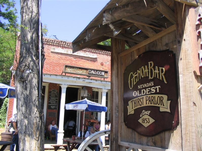
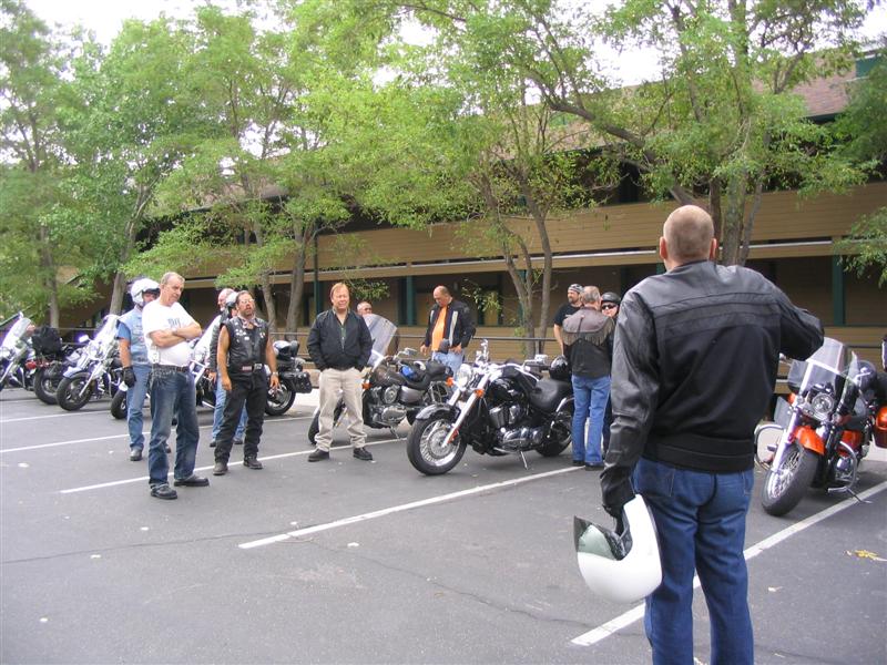
We didn't wear flowers in our hair:-)

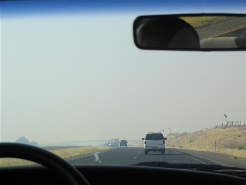
We left Stockton heading for San Francisco in Don's car. He chose back roads and ended up taking us over the two-lane twisty Altamonte Pass Road. This is the same Altamonte where the infamous Rolling Stones concert secured by the Hell's Angels encountered trouble in the late 60's. The road is excellent and would be much better on two wheels. There was a large recent burn on one side, making the stories of California grass fires much more personal. We also saw more windmills than I have ever seen before in one place. Many of them were smaller than the ones in other places but the quantity was unbelievable. One website suggests there may be 5,400 of them.

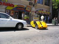
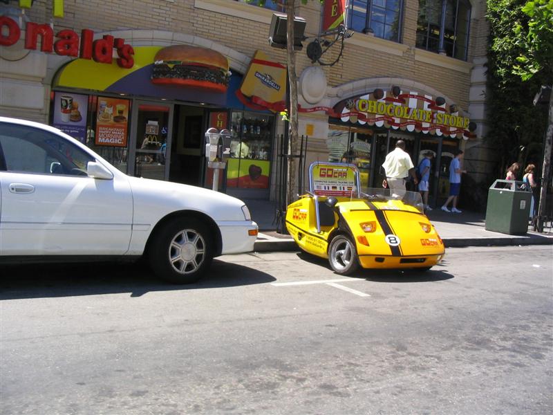
We crossed the Bay Bridge into San Francisco. We could see a large fog bank with the tips of two towers sticking out where the Golden Gate Bridge should be. The fog seemed to be centred around the bridge. Temperatures were in the 70's, which Don assures us are much warmer than usual. This little yellow creation was one of the first we saw. They are rentals, the riders need to wear helmets and they are everywhere. Traffic, both vehicle and pedestrian, was very heavy as we moved along The Embarcadero towards Fisherman's Wharf.

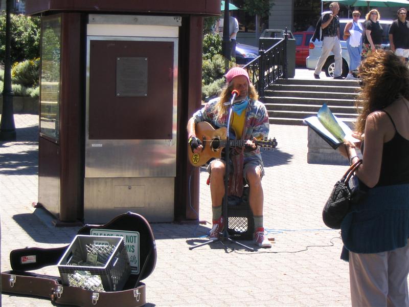
Don dropped us off at the Wharf where the cable cars start their route. He said he would meet us at the other end but I took my cell phone just in case. I didn't want to be stranded in San Francisco because I misunderstood the directions. After buying tickets, we waited for a while in line. We met a couple from Lincolnshire England on a two week visit and a family of five who 
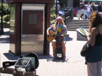
moved to Connecticut eight years ago and were visiting their old home. We were entertained in line buy a very good singer who had an eclectic selection of songs.

As we climbed aboard the cable car, everyone jockeyed for position. We ended up in the open front seats facing right. Others were inside and some were hanging off the running boards in front of us. As the car started up the Hyde Street Hill, composed of three uphills separated by flat cross streets, it brought to mind the initial climb of a roller coaster. The hill was that steep. The operator controlled the car with two levers, one which grabbed a moving underground cable for propulsion and the other one for braking. There are sensors in the road to trip the traffic lights so that the car doesn't have to stop. We passed famous places like California Street, Lombard Street and Chinatown going up and down hills before finally arriving at the end point. There we found Don relaxing in one of the empty cable cars.

After getting to the car, we started following the 49 Mile Scenic Drive route using a tourist guide map and signs (not always there) on the side of the road. As we approached AT&T Park, it was evident that a ball game was going on. Don switched on the radio and found the game as we were in front of the park, just in time to hear someone hit a home run. We heard the cheering on the radio and then turned it off so we could hear the same cheering first hand from the stadium.

We followed the Scenic Drive through the city with Don pointing out points of interest. Eventually, we wound our way up the end of Lombard Drive to the 
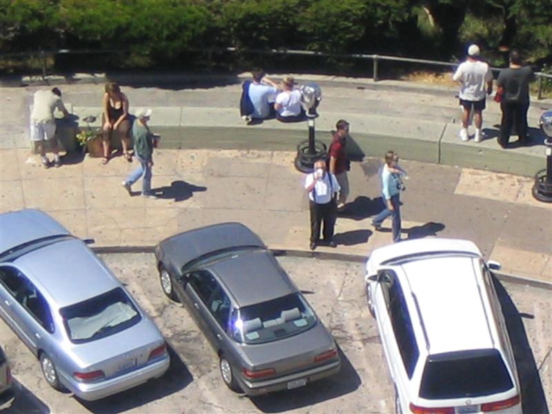
Coit Tower on Telegraph Hill. There was a line-up for parking so Don let us out to go inside while he waited. We bought tickets and then waited in line for about 20 minutes for the elevator ride to the top. The young couple ahead of us were Scandinavian and were talking back and forth (we didn't understand a word) with a lot of touching and kissing. I tried to study the murals on the walls around us since I didn't want to stare.

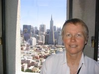
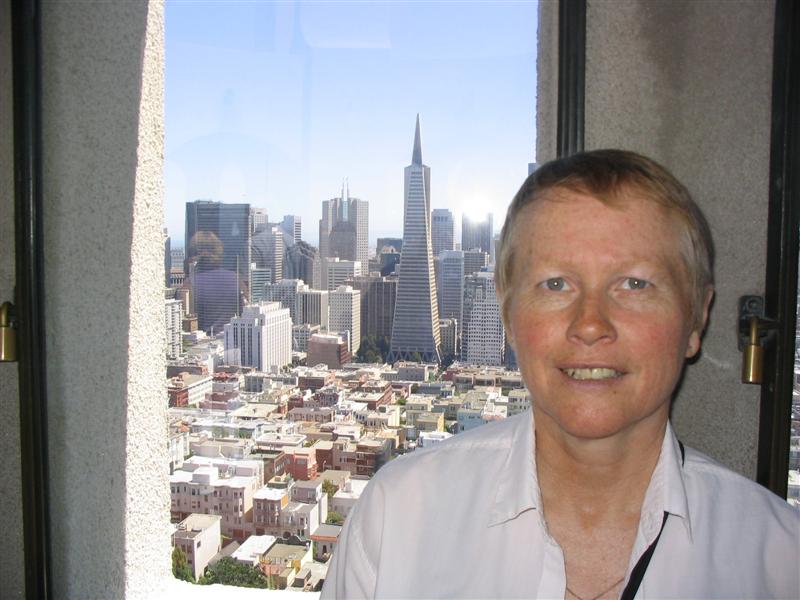
Eventually, we got to ride to the top. The view was spectacular. Alcatraz, Fisherman's Wharf, some of the Golden Gate Bridge Sandy is pictured with the Trans-America Tower, a famous SF landmark, in the background. I also got a shot of Don enjoying a Snapple as he waited for us down below. The last shot is of Sandy and Don in front of the tower.

From there, we worked our way around the shore to 
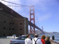
Fort Point, almost directly under the Golden Gate Bridge. Don and Sandy pondered the bridge as the waves crashed into the rocks in front of us. The currents under the bridge are severe, but there were a group of people obviously racing kayaks.

The next area we went through was the Presidio. We took a side trip from the official tour to check out the Officer's Club, which is now the Visitor Centre maintained by the National Park Service. We continued to and are known as Sea Cliff, which features opulent homes overlooking the Golden Gate Bridge. The lowliest of these apparently commands multi-millions of dollars. The neighborhood is immaculate and breathtaking. Strangely enough, immediately after this is a municipal golf course, Lincoln Park, owned by the City. The contrast of the rich and famous living next to the average man playing golf is kind of strange.

We took another sidetrip to 31st Street to look at a house owned by Don's aunt and uncle. This little place, pictured here and typical of many in the area, is estimated on a real estate website to be worth from 0.9 to 1.2 million dollars. Any thought I might ever have had of relocating to San Francisco just went out the window.

We got back on track and went out by Cliff House but it was, as with many things this day, too crowded to get a parking space. We continued south down the coast along the Great Highway, getting glimpses through the dunes of the beach and surfers riding the incoming breakers. Then we looped around Lake Merced and its five golf courses, heading back north past Don's Alma Mater, San Franciso State University.

We again broke away from the route to stop for food at the Park Chow restaurant on 9th Avenue between Lincoln and Irving. Don had an eggplant concoction while Sandy and I had meatball and provolone sandwiches. The food was good. A short walk after dinner revealed Japanese, Chinese, Korean and Italian restauarants within a block. We found this area of Irving was an old style neighborhood that was formerly Jewish but was rapidly becoming an Asian enclave.

Back to the route, we took a circuitous route through Golden Gate Park and then a drive through Haight Ashbury, home of the summer of love hippy movement in the 60's. We passed right through the intersection of Haight and Ashbury Streets. Many hippies appear to still be here.

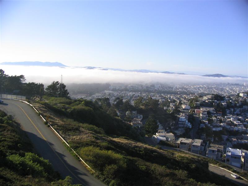
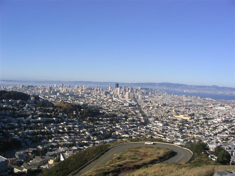
The next stop was the top of Twin Peaks which, at 900 feet elevation, provides a panoramic view of the San Francisco area. The fog had already moved back in over the Golden Gate and we were able to watch it actually swallowing buildings in front of our eyes. It brought to mind Stephen King novels. We watched it roll in for a while, inexorably engulfing the city.

The downtown part of the city was, as yet, untouched by the fog and spread below us (looking straight down Market Street) like a collection of toy houses.

Twin Peaks brought and end to the tour and we worked our way back across the Mission District to Highway 101 South and on to the San Mateo Bridge. Don commented on how light the traffic was as we returned to Stockton via interstates.

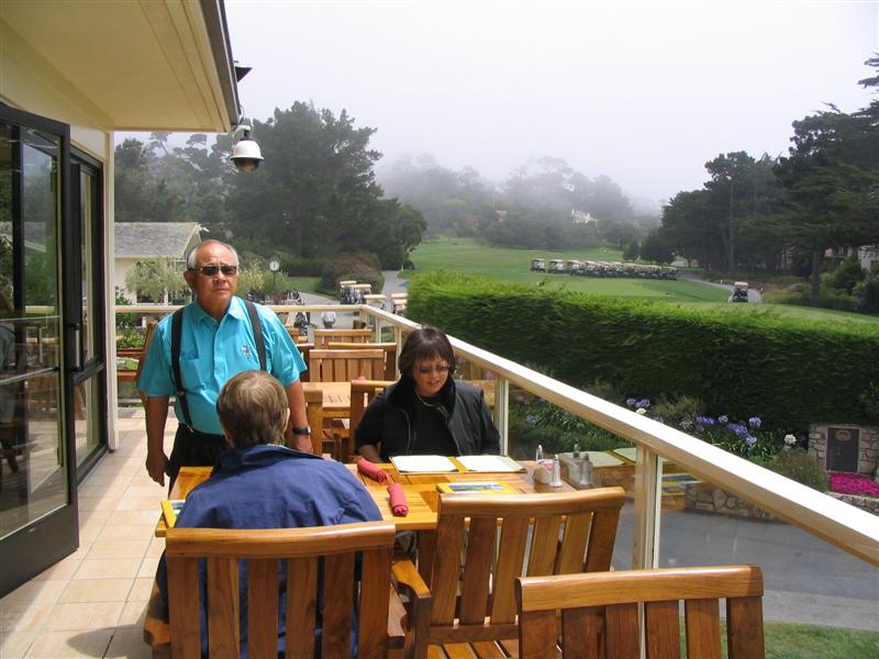
Back at the house, Sandy turned on the Weather Channel to watch a special called "It Could Happen Tomorrow". This dealt with the possibility of another San Francisco earthquake with a magnitude of the one that occurred 100 years ago. Many of the shots in the program were of places we were at today. Then Sandy turned in, I worked on the Blog and Don plotted the route for tomorrow's visit to Monterey.

Saturday, July 15, 2006

Stockton California - The San Joaquin Delta

Delta Day

The first decision of the day was clothing. Don was going to show us the Brookside Golf Club where he spends his non-riding days. The only snag was that the men's dress code specified no jeans and a shirt with a collar. Perfect, except that all I have is jeans and T-shirts. Don dragged out an old golf shirt and a new pair of pants he hasn't had shortened yet. They fit me just fine, so off we went to the course.

Brookside is a beautiful course surrounded by a gated golf community. The clubhouse is a fine building and it all is much nicer than anything Sudbury has to offer. It looks like it would be a fine place to make a second home.

Leaving the golf course, we headed north on I-5 and got off at the Lodi Flying J. As we went by, I saw the HD TV truck from Wendover and Nebraska. We went north past Thornton and then headed west to the Sacramento River. Now I've always pictured Louisiana when I though of deltas and levees but the Stockton area has a similar thing. The delta of the San Joaquin and Sacarmento Rivers is similar. The marshland was reclaimed through the construction of many miles of levees and the islands created are used for farming. Most of the roads run across the tops of the levees.

First stop was Locke. This was constructed about 1915 by the chinese labourers after the Chinatown section of Walnut Grove was destroyed by fire and is the only town in America constructed solely by Chinese. It became run down but recently people have started buying and refurbishing the buildings. There are now art galleries and some stores. In the middle of it all stands Als' Place, better known as Al The Wop's. The building was built in 1915 and bought by Al in 1934. Al passed away in 1961 but the bar and restauarant are still going strong. We stopped in for a coke. Just like at Snick's in Boscobel Wisconsin, the ceiling is littered with one dollar bills.

From Locke, we moved down the levee to Walnut Grove, where we got down off the levee and drove around the streets. It is a bit spooky knowing the water in the river is higher than the streets you are driving on. Then we got back on the levee road and, out in the middle of nowhere, came to the Grand Island Mansion. There was a wedding going on on the property, so we just stopped for a quick picture.

On the way back to Isleton for lunch, we encountered two places where there were no bridges across the river. CalTrans operates ferrys across the river since these are state highways. On has a boat pushing it, but the other is a cable ferry, pulling the barge along a submerged cable across the river.

We arrived at the River's Edge Cafe in Isleton just after the family and friends had gotten there. It was Don's father Frank's 93rd birthday and the mood was festive. The staff know the Inamasu's and it almost felt like home. I had a BLT with a honey glazed bacon on foccacia bread that was excellent. Sandy had the shrimp Louie salad special.

Frank, sitting across from Sandy (Leona is to the right between him and Don) enjoyed a polenta lasagna and is admiring a giant birthday cookie the restaurant made for him.

After lunch, we headed back to Ryde for a look at the Ryde Hotel. The hotel was built in 1927 at the peak of the prohibition era and featured a beauty salon, barber shop, speakeasy and (rumoured) a bordello. It has recently been restored back to its former glory and features 32 rooms of various sizes and a reknowned champagne Sunday brunch. The room rates through the week are fairly reasonable. There is a small 'executive' golf course out back. Unlike other places, the Ryde is built on top of the levee instead of down at or below water level.

After Ryde, we followed the levees to the edge of the delta, closer to Mount Diablo and near a very active wind farm. We went past Antioch and Brentwood and stopped at a small farm market to get some Brentwood white corn on the cob for Don's sister Laura.

On the way back to Stockton on SR 4, we took a detour to look at the Jones Tract, one of the islands created by the levee system. This island suffered a levee breach in 2003 and became a huge lake. At Trapper Slough, we took the road that the map showed going around the island. A large sign indicated this was not a through road, but we (the intrepid adventurers) went ahead and tried anyway. The sign lied. While there was a section of unmaintained road on the north side, we did get all the way around. We stopped and had a look at the site of the break and pondered the volume of water that had to be pumped out. The job was completed in 2004 and the fields are back in full production today.

In Stockton, we detoured through the Port of Stockton, a deep water port that sees ships come in via the Sacramento and San Joaquin Rivers with the assistance of river pilots and tugs. Some companies maintain major distribution centres here to avoid the coast traffic. Don was going to show us a downtrodden area and took us through a place called Boggs Tract. To his surpise, the building are being refurbished and, while not upscale, it looks like a decent neighborhood.

We arrived at the home of Don's parents and sister to find that Laura had hit a truck tire carcass on the way back from Isleton and that 'something' was hanging down under the car. It turns out it was the plastic skid plate protecting the underside of the engine. I wedged it back in place and she will take it to the dealer to be checked out. Looks like she was lucky. Leona cooked some of the Brentwood white corn and we each had a cob. It is a sweet corn, very tasty. Here Don and Laura are enjoying some corn.

Oh Lord, Stuck In Lodi Again

From Stockton, we headed north again to Lodi for the Lodi Buddhist Church Bazaar. They has a block closed off and many people were wandering, enjoying the food and games. Don ordered some Japanese dishes and we sat down and enjoyed them, washed down with A&W rootbeer which (Don tells me) originated in Lodi. Here he is explaining the nuances of tempura, sushi and teryaki to Sandy. They also offered steak sandwiches and hamburgers across the way for those with a more American taste, but most of the people were eating the Japanese food. The atmosphere was festive.

One treat in the community centre was a display by the Sacramento Japanese Sword Club. I had an extended conversation with this gentleman who owned many swords. He described the process of making the legendary blades, which he has seen done in Japan, and told me that now new blades from top level craftsmen are bringing the same price as the antique blades due to demand. The waiting list for a new blade is measured in years. The oldest blade on display here was from the 1600's and looked like new. The oldest in his collection was from the 1300's.

On the way out of Lodi, we drove through downtown. With all the concerns about downtowns falling into disrepair, Lodi is a pleasant surprise as people congregated and wandered the sidewalks. It was almost a magical place.

It was about 101 today and tomorrow should be hotter so we are going to San Francisco to cool off.